IMAGES TAKEN NEAR TO
Stonebridge Avenue, LEEDS, LS12 5AL
Introduction
This page details the photographs taken nearby to Stonebridge Avenue, LS12 5AL by members of the Geograph project.
The Geograph project started in 2005 with the aim of publishing, organising and preserving representative images for every square kilometre of Great Britain, Ireland and the Isle of Man.

There are currently over 7.5m images from over14,400 individuals and you can help contribute to the project by visiting https://www.geograph.org.uk
Image Map
Images are licensed for reuse under creativecommons.org/licenses/by-sa/2.0
Notes
- Clicking on the map will re-center to the selected point.
- The higher the marker number, the further away the image location is from the centre of the postcode.
Image Listing (67 Images Found)
Images are licensed for reuse under creativecommons.org/licenses/by-sa/2.0
Image
Details
Distance
1
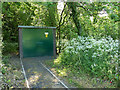
Butterbowl Mills substation
The name was that of a textile mill, already shown as disused on the 1908 map, and no longer extant. The site now has other industrial uses, but the name remains.
Image: © Stephen Craven
Taken: 21 May 2020
0.07 miles
2
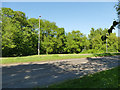
Green space by the Leeds Ring Road
The Wortley Beck flows through the trees beyond it.
Image: © Stephen Craven
Taken: 21 May 2020
0.08 miles
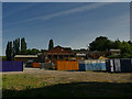
3
Huts off the Leeds Ring Road (2)
Some of these, at least, appeared to be pigeon roosts. Note the yappy dog in the foreground.
Image: © Stephen Craven
Taken: 21 May 2020
0.08 miles
4
Huts off the Leeds Ring Road
Some of these, at least, appeared to be pigeon roosts; as there were horses in an adjacent field, others may be stables.
Image: © Stephen Craven
Taken: 21 May 2020
0.09 miles
5
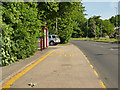
Bus stop on Leeds Ring Road
Served by route 9 (Pudsey to White Rose Centre)
Image: © Stephen Craven
Taken: 21 May 2020
0.10 miles
6
Butterbowl Mills
The name was that of a textile mill, already shown as disused on the 1908 map, and no longer extant. The site now has other industrial uses, but the name remains.
Image: © Stephen Craven
Taken: 21 May 2020
0.11 miles
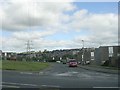
8
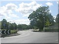
Farnley Ring Road - viewed from Stonebridge Lane
Image: © Betty Longbottom
Taken: 9 Aug 2011
0.13 miles
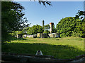
9
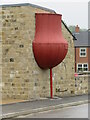
Stonebridge Mills - water tank
These old mills are Listed Grade II but have been partially demolished and converted to housing. This tank is an inverted wagon boiler that has been repurposed. It has been conserved but I think only the visible part may survive and the building it is attached to may well have been rebuilt judging from an aerial view of work in progress.
Image: © Chris Allen
Taken: 5 May 2023
0.13 miles
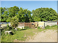
10
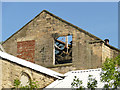
Roofless building at Stonebridge Mills
This grade II listed mill building (list entry 1255993) is starting to decay.
Image: © Stephen Craven
Taken: 21 May 2020
0.14 miles