IMAGES TAKEN NEAR TO
Stonebridge Lane, LEEDS, LS12 5AH
Introduction
This page details the photographs taken nearby to Stonebridge Lane, LS12 5AH by members of the Geograph project.
The Geograph project started in 2005 with the aim of publishing, organising and preserving representative images for every square kilometre of Great Britain, Ireland and the Isle of Man.

There are currently over 7.5m images from over14,400 individuals and you can help contribute to the project by visiting https://www.geograph.org.uk
Image Map
Images are licensed for reuse under creativecommons.org/licenses/by-sa/2.0
Notes
- Clicking on the map will re-center to the selected point.
- The higher the marker number, the further away the image location is from the centre of the postcode.
Image Listing (99 Images Found)
Images are licensed for reuse under creativecommons.org/licenses/by-sa/2.0
Image
Details
Distance
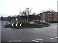
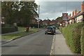
2
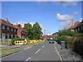
Modern housing on Stonebridge Lane, Farnley
The 1908 map shows that there were terraced houses (possibly back-to-backs) here previously. Behind the flats is a major electrical substation.
Image: © Stephen Craven
Taken: 9 Sep 2020
0.03 miles
3
Stonebridge Lane - viewed from Stonebridge Grove
Image: © Betty Longbottom
Taken: 9 Aug 2011
0.04 miles
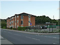
4
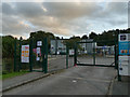
Ryecroft Academy, Stonebridge Grove, Farnley
A modern primary school, and like all schools these days almost impossible to photograph through the security fence. The name is not a local one; there is another school of the same name in Bradford, near the much older Ryecroft Hall Image so that is probably where the name originates.
Image: © Stephen Craven
Taken: 9 Sep 2020
0.04 miles
5
Stonebridge Grove - Stonebridge Lane
Image: © Betty Longbottom
Taken: 9 Aug 2011
0.05 miles
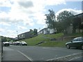
6
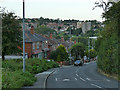
Stonebridge Lane, Farnley
One of the steepest hills in the area, with a gradient of 1 in 6 (17%).
Image: © Stephen Craven
Taken: 9 Sep 2020
0.05 miles
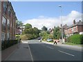
7
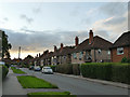
Houses on Stonebridge Grove, Farnley
The balconies are an unusual feature on what I presume were built as council houses.
Image: © Stephen Craven
Taken: 9 Sep 2020
0.06 miles
9
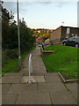
Steps parallel to Stonebridge Lane
For pedestrians, an alternative to walking up the steep Stonebridge Lane is to use these steps that connect the various levels of a housing estate on the hillside.
Image: © Stephen Craven
Taken: 9 Sep 2020
0.09 miles