IMAGES TAKEN NEAR TO
Langton Green, LEEDS, LS12 4EJ
Introduction
This page details the photographs taken nearby to Langton Green, LS12 4EJ by members of the Geograph project.
The Geograph project started in 2005 with the aim of publishing, organising and preserving representative images for every square kilometre of Great Britain, Ireland and the Isle of Man.

There are currently over 7.5m images from over14,400 individuals and you can help contribute to the project by visiting https://www.geograph.org.uk
Image Map
Images are licensed for reuse under creativecommons.org/licenses/by-sa/2.0
Notes
- Clicking on the map will re-center to the selected point.
- The higher the marker number, the further away the image location is from the centre of the postcode.
Image Listing (116 Images Found)
Images are licensed for reuse under creativecommons.org/licenses/by-sa/2.0
Image
Details
Distance
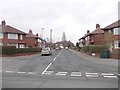
4
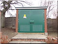
Electricity Substation No 7587 - Dixon Lane
Image: © Betty Longbottom
Taken: 27 Feb 2012
0.06 miles
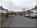
5
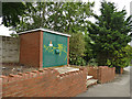
Substation on Dixon Lane
Opposite Kellett Road.
Image: © Stephen Craven
Taken: 29 Jun 2020
0.06 miles
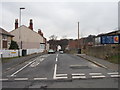
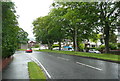
7
Greenside Drive - looking towards Dixon Lane
Image: © Betty Longbottom
Taken: 27 Feb 2012
0.07 miles
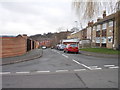
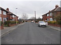
8
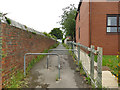
Public footpath from Lynwood Garth to Dixon Lane
Part of a longer chain of urban footpaths following a much older route from Wortley into Leeds.
Image: © Stephen Craven
Taken: 29 Jun 2020
0.07 miles
9
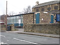
St John the Evangelist Church Hall - Dixon Lane Road
Image: © Betty Longbottom
Taken: 27 Feb 2012
0.07 miles