IMAGES TAKEN NEAR TO
St. James Mews, LEEDS, LS12 3UT
Introduction
This page details the photographs taken nearby to St. James Mews, LS12 3UT by members of the Geograph project.
The Geograph project started in 2005 with the aim of publishing, organising and preserving representative images for every square kilometre of Great Britain, Ireland and the Isle of Man.

There are currently over 7.5m images from over14,400 individuals and you can help contribute to the project by visiting https://www.geograph.org.uk
Image Map
Images are licensed for reuse under creativecommons.org/licenses/by-sa/2.0
Notes
- Clicking on the map will re-center to the selected point.
- The higher the marker number, the further away the image location is from the centre of the postcode.
Image Listing (144 Images Found)
Images are licensed for reuse under creativecommons.org/licenses/by-sa/2.0
Image
Details
Distance
1
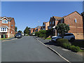
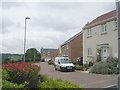
St James's Mews, Armley
This modern housing estate appears to have completely replaced an earlier settlement called Hill End.
Image: © Stephen Craven
Taken: 25 Jun 2020
0.02 miles
2
St James' Mews - St Mary's Park Crescent
Image: © Betty Longbottom
Taken: 25 Jul 2011
0.03 miles
3
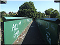
Railway footbridge off Heights Way, Armley
Like many such provisions, this bridge represents the continuation of a right of way older than both the railway and surrounding houses. The present bridge structure of steel is relatively modern.
Image: © Stephen Craven
Taken: 25 Jun 2020
0.05 miles
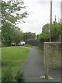
5
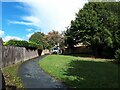
Path to Hill End Road
From St Mary's Park Approach.
Image: © Stephen Craven
Taken: 9 Sep 2022
0.05 miles
6
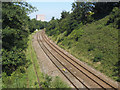
Railway west of Heights Way footbridge, Armley
Two tracks remain of the original four on the original Leeds to Bradford Exchange line.
Image: © Stephen Craven
Taken: 25 Jun 2020
0.05 miles
7
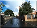
St Mary's Park Approach
Despite the name there is no park at the end of this road, unless you count a small green space of a quarter of a hectare Image 'Approach' here just means it's the spine road of a housing estate.
Image: © Stephen Craven
Taken: 9 Sep 2022
0.05 miles
8
Swallow View - end of Hill End Crescent
Image: © Betty Longbottom
Taken: 25 Jul 2011
0.06 miles
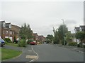
9
Hill End Road - looking towards Hill Top Road
Image: © Betty Longbottom
Taken: 25 Jul 2011
0.06 miles
10
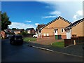
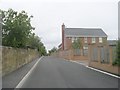
Hill End Road, Armley
The road was glistening after a short but heavy shower.
Image: © Stephen Craven
Taken: 9 Sep 2022
0.06 miles