IMAGES TAKEN NEAR TO
Woodland Square, LEEDS, LS12 3UP
Introduction
This page details the photographs taken nearby to Woodland Square, LS12 3UP by members of the Geograph project.
The Geograph project started in 2005 with the aim of publishing, organising and preserving representative images for every square kilometre of Great Britain, Ireland and the Isle of Man.

There are currently over 7.5m images from over14,400 individuals and you can help contribute to the project by visiting https://www.geograph.org.uk
Image Map
Images are licensed for reuse under creativecommons.org/licenses/by-sa/2.0
Notes
- Clicking on the map will re-center to the selected point.
- The higher the marker number, the further away the image location is from the centre of the postcode.
Image Listing (153 Images Found)
Images are licensed for reuse under creativecommons.org/licenses/by-sa/2.0
Image
Details
Distance
1
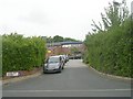
Woodland Square - St Mary's Park Crescent
Image: © Betty Longbottom
Taken: 25 Jul 2011
0.03 miles
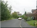
2
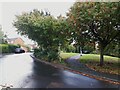
St Mary's Park Crescent
As you would expect from the name, the road curves round, but there is a direct path across the green space. See also Image taken from the other end.
Image: © Stephen Craven
Taken: 9 Sep 2022
0.04 miles
3
Poplar Close, Armley
See Image taken eleven years earlier.
Image: © Stephen Craven
Taken: 9 Sep 2022
0.05 miles
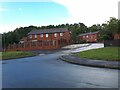
5
Small green space, St Mary's Park Crescent, Armley
A very small space in the loop formed by the crescent, not much longer than can be seen here and only 0.2ha (0.5 acre) in size.
Image: © Stephen Craven
Taken: 25 Jun 2020
0.05 miles
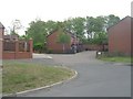
6
St Mary's Park Crescent - viewed from St Mary's Park Approach
Image: © Betty Longbottom
Taken: 25 Jul 2011
0.06 miles
8
St Mary's Park Approach - viewed from St Mary's Park Crescent
Image: © Betty Longbottom
Taken: 25 Jul 2011
0.06 miles
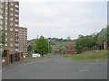
9
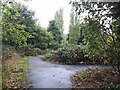
Path junction above Poplar Mount
OpenStreetMap suggested that there is a direct path from St Mary's Park Crescent to the end of Poplar Way. There isn't, but there is this more indirect route. Not the sort of path I would want to walk alone at night, even as a man.
Image: © Stephen Craven
Taken: 9 Sep 2022
0.06 miles
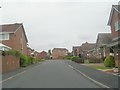
10
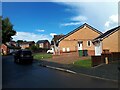
St Mary's Park Approach
Despite the name there is no park at the end of this road, unless you count a small green space of a quarter of a hectare Image 'Approach' here just means it's the spine road of a housing estate.
Image: © Stephen Craven
Taken: 9 Sep 2022
0.07 miles