IMAGES TAKEN NEAR TO
Heights Walk, LEEDS, LS12 3SL
Introduction
This page details the photographs taken nearby to Heights Walk, LS12 3SL by members of the Geograph project.
The Geograph project started in 2005 with the aim of publishing, organising and preserving representative images for every square kilometre of Great Britain, Ireland and the Isle of Man.

There are currently over 7.5m images from over14,400 individuals and you can help contribute to the project by visiting https://www.geograph.org.uk
Image Map
Images are licensed for reuse under creativecommons.org/licenses/by-sa/2.0
Notes
- Clicking on the map will re-center to the selected point.
- The higher the marker number, the further away the image location is from the centre of the postcode.
Image Listing (146 Images Found)
Images are licensed for reuse under creativecommons.org/licenses/by-sa/2.0
Image
Details
Distance
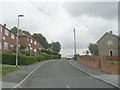
2
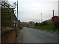
Heights Way - viewed from Heights Walk
Image: © Betty Longbottom
Taken: 25 Jul 2011
0.04 miles
3
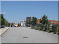
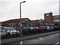
Dixons Unity Academy, Armley from Heights Drive
Formerly known as Swallow Hill Community College Image, this secondary school for pupils aged 11-16 became part of a Multi Academy Trust in 2018. This is the view from the principal entrance on Heights Drive.
Image: © Stephen Craven
Taken: 25 Jun 2020
0.06 miles
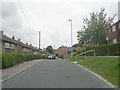
4
Swallow Hill Community College - viewed from Congress Mount
Image: © Betty Longbottom
Taken: 31 May 2011
0.06 miles
5
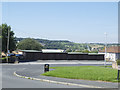
Lock-up garages on Heights Drive, Armley
Image: © Stephen Craven
Taken: 25 Jun 2020
0.06 miles
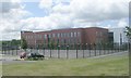
6
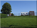
Dixons Unity Academy, Armley from Heights Walk
Formerly known as Swallow Hill Community College Image, this secondary school for pupils aged 11-16 became part of a Multi Academy Trust in 2018. This is the view from Heights Walk.
Image: © Stephen Craven
Taken: 25 Jun 2020
0.06 miles
9
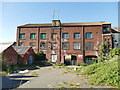
Former mill, Tong Road
Shown as a woollen mill on the 1908 map. This is the rear view from Silver Royd Hill.
Image: © Stephen Craven
Taken: 21 May 2020
0.09 miles
10
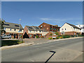
Marsden Street, off Silver Royd Hill
This is a modern housing development consisting of just six semi-detached houses. It takes its name from one of two streets consisting of a total of around thirty back-to-back terraces that formerly occupied the site (the other being Walter Place). Much nicer living conditions, but it shows how housing density is much reduced.
Image: © Stephen Craven
Taken: 21 May 2020
0.09 miles