IMAGES TAKEN NEAR TO
Thornton Gardens, LEEDS, LS12 3JE
Introduction
This page details the photographs taken nearby to Thornton Gardens, LS12 3JE by members of the Geograph project.
The Geograph project started in 2005 with the aim of publishing, organising and preserving representative images for every square kilometre of Great Britain, Ireland and the Isle of Man.

There are currently over 7.5m images from over14,400 individuals and you can help contribute to the project by visiting https://www.geograph.org.uk
Image Map
Images are licensed for reuse under creativecommons.org/licenses/by-sa/2.0
Notes
- Clicking on the map will re-center to the selected point.
- The higher the marker number, the further away the image location is from the centre of the postcode.
Image Listing (328 Images Found)
Images are licensed for reuse under creativecommons.org/licenses/by-sa/2.0
Image
Details
Distance
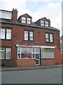
3
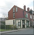
The Sandwich Savoury - Wortley Road
Image: © Betty Longbottom
Taken: 25 Apr 2010
0.04 miles
4
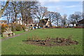
Moor Top
Moor Top is one of the 6 pieces of land given to the people of Armley in 1799 as part of the enclosures act. The 'Armley Common Rights Trust' still manage these parks through a board of trustees and volunteers
Image: © Alison Covey
Taken: 17 Feb 2007
0.04 miles
5
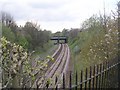
View from Bridge LBE1/10 - Wortley Road
Image: © Betty Longbottom
Taken: 25 Apr 2010
0.04 miles