IMAGES TAKEN NEAR TO
Houghley Square, LEEDS, LS12 2SY
Introduction
This page details the photographs taken nearby to Houghley Square, LS12 2SY by members of the Geograph project.
The Geograph project started in 2005 with the aim of publishing, organising and preserving representative images for every square kilometre of Great Britain, Ireland and the Isle of Man.

There are currently over 7.5m images from over14,400 individuals and you can help contribute to the project by visiting https://www.geograph.org.uk
Image Map
Images are licensed for reuse under creativecommons.org/licenses/by-sa/2.0
Notes
- Clicking on the map will re-center to the selected point.
- The higher the marker number, the further away the image location is from the centre of the postcode.
Image Listing (241 Images Found)
Images are licensed for reuse under creativecommons.org/licenses/by-sa/2.0
Image
Details
Distance
1
Cut-through from Raynville Gardens to Houghley Avenue
Houghley Avenue used to continue through to Wyther Park Hill but became a dead end for vehicles when the latter road was redeveloped and renamed. Pedestrian and cycle access is still possible.
Image: © Stephen Craven
Taken: 7 Jan 2021
0.03 miles
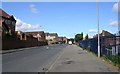
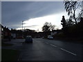
4
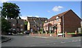
Raynville Crescent - Armley Ridge Road
Image: © Betty Longbottom
Taken: 12 Jul 2011
0.05 miles
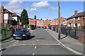
7
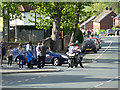
What road closure? (2)
The traffic management of the 2019 Tour de Yorkshire, as it passed through west Leeds, left much to be desired. Notices had been up for weeks warning of road closures, but there were no barriers and few police or other marshals, and several drivers defied the closure. Here, a minicab driver is being confronted by a police rider, and kept trying to get past the policeman. Eventually the minicab turned round and went the other way
Image: © Stephen Craven
Taken: 5 May 2019
0.06 miles
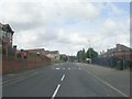
8
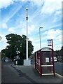
New telecoms mast on Armley Ridge Road
This tall mobile phone mast has appeared in the last couple of months. Such installations no longer require planning permission.
There is a bus stop adjacent. The sign indicating buses to 'Bramley, Gledhow, Headingley, Kirkstall' is misleading: it is only served now by route 14 to Bramley and Pudsey, the bus to Headingley having been withdrawn a few years ago, and even the 14 route is currently under threat.
Image: © Stephen Craven
Taken: 1 Aug 2022
0.06 miles
9
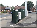
Telecoms mast control cabinets on Armley Ridge Road
See Image for the mast itself. This is a new installation.
Image: © Stephen Craven
Taken: 1 Aug 2022
0.06 miles
10
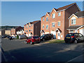
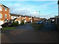
Manderston Chase, Bramley
An unusual name for a short residential side street at the end of Raynville Gardens. Another contributor calls it Manderston Close Image which is a more common street name suffix, but I am using the name from Google maps.
Image: © Stephen Craven
Taken: 19 Jul 2018
0.06 miles