IMAGES TAKEN NEAR TO
Raynville Crescent, LEEDS, LS12 2ST
Introduction
This page details the photographs taken nearby to Raynville Crescent, LS12 2ST by members of the Geograph project.
The Geograph project started in 2005 with the aim of publishing, organising and preserving representative images for every square kilometre of Great Britain, Ireland and the Isle of Man.

There are currently over 7.5m images from over14,400 individuals and you can help contribute to the project by visiting https://www.geograph.org.uk
Image Map
Images are licensed for reuse under creativecommons.org/licenses/by-sa/2.0
Notes
- Clicking on the map will re-center to the selected point.
- The higher the marker number, the further away the image location is from the centre of the postcode.
Image Listing (228 Images Found)
Images are licensed for reuse under creativecommons.org/licenses/by-sa/2.0
Image
Details
Distance
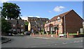
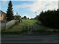
3
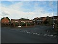
Footpath to Manderston Close - Raynville Crescent
Image: © Betty Longbottom
Taken: 12 Jul 2011
0.04 miles
4
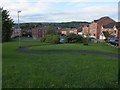
Curved path up from Manderston Chase
The serpentine path makes its way uphill on an easy gradient with links to several residential streets either side.
Image: © Stephen Craven
Taken: 23 Apr 2020
0.04 miles
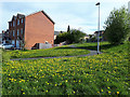
5
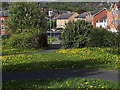
Dandelion giveaway
A lack of dandelions gives away the desire line where people have cut off the corner of the serpentine path Image
Image: © Stephen Craven
Taken: 23 Apr 2020
0.04 miles
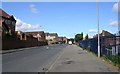
6
Cut-through from Raynville Gardens to Houghley Avenue
Houghley Avenue used to continue through to Wyther Park Hill but became a dead end for vehicles when the latter road was redeveloped and renamed. Pedestrian and cycle access is still possible.
Image: © Stephen Craven
Taken: 7 Jan 2021
0.05 miles
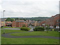
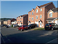
7
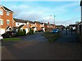
Social housing, Wensleydale Crescent
Housing provided by Leeds Federated Housing Association.
Image: © Stephen Craven
Taken: 22 May 2016
0.05 miles
8
Footpath from Raynville Crescent to Raynville Way
It is not clear whether the path snakes like this to minimise the gradient or merely for aesthetic effect. Compare Image
Image: © Stephen Craven
Taken: 22 May 2016
0.05 miles
9
Footpath from Raynville Crescent to Wyther Park Hill
It is not clear whether the path snakes like this to minimise the gradient or merely for aesthetic effect. Compare Image looking the other way.
Image: © Stephen Craven
Taken: 22 May 2016
0.05 miles
10
Manderston Chase, Bramley
An unusual name for a short residential side street at the end of Raynville Gardens. Another contributor calls it Manderston Close Image which is a more common street name suffix, but I am using the name from Google maps.
Image: © Stephen Craven
Taken: 19 Jul 2018
0.05 miles