IMAGES TAKEN NEAR TO
Armley Ridge Road, LEEDS, LS12 2QT
Introduction
This page details the photographs taken nearby to Armley Ridge Road, LS12 2QT by members of the Geograph project.
The Geograph project started in 2005 with the aim of publishing, organising and preserving representative images for every square kilometre of Great Britain, Ireland and the Isle of Man.

There are currently over 7.5m images from over14,400 individuals and you can help contribute to the project by visiting https://www.geograph.org.uk
Image Map
Images are licensed for reuse under creativecommons.org/licenses/by-sa/2.0
Notes
- Clicking on the map will re-center to the selected point.
- The higher the marker number, the further away the image location is from the centre of the postcode.
Image Listing (178 Images Found)
Images are licensed for reuse under creativecommons.org/licenses/by-sa/2.0
Image
Details
Distance
1
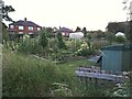
Allotments off Armley Ridge Road, south side
The allotments are either side of an access track.
Image: © Stephen Craven
Taken: 21 Sep 2020
0.02 miles
3
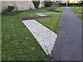
Tactile paving, Gott's Park
Since my last photo of the former rose garden Image, it has been restored to new uses. I presume the intention of this paving is to walk it barefoot and feel the different textures.
Image: © Stephen Craven
Taken: 6 Apr 2020
0.03 miles
5
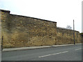
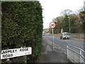
Eroded stone wall on Armley Ridge Road
The original choice of stone for this wall - a soft and thinly laminated sandstone - was not appropriate, and it has weathered badly. See Image for detail.
Image: © Stephen Craven
Taken: 9 Dec 2017
0.04 miles
6
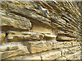
Eroded stone wall on Armley Ridge Road - detail
The original choice of stone for this wall - a soft and thinly laminated sandstone - was not appropriate, and it has weathered badly. See Image for context.
Image: © Stephen Craven
Taken: 9 Dec 2017
0.04 miles
7
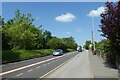
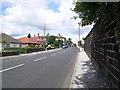
Cycle path along Stanningley Road
CS1, the Leeds-Bradford cycle superhighway running beside the road.
Image: © DS Pugh
Taken: 26 May 2023
0.05 miles
8
The roseless garden in Gott's Park
This is supposed to be a Rose Garden. Three years ago it still was Image, but this year the roses have been removed and nothing yet planted in their place.
Image: © Stephen Craven
Taken: 19 Jul 2018
0.05 miles
9
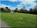
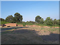
Former rose garden, Gott's Park
Five years earlier this was still a rose garden Image but it has now been grassed over, with a fine crop of dandelions in April, You can however see the evidence of former use in the raised strips that ran between the various rose beds.
Image: © Stephen Craven
Taken: 25 Apr 2021
0.05 miles
10
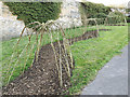
Willow tunnel awaiting leaves, Gott's Park
Since my last photo of the former rose garden Image, it has been restored to new uses. When the climbing plants around this willow frame, created in March 2020, have grown and sprouted leaves it will make a fine tunnel for young children to explore.
Image: © Stephen Craven
Taken: 6 Apr 2020
0.05 miles