IMAGES TAKEN NEAR TO
Holdforth Gardens, LEEDS, LS12 1YH
Introduction
This page details the photographs taken nearby to Holdforth Gardens, LS12 1YH by members of the Geograph project.
The Geograph project started in 2005 with the aim of publishing, organising and preserving representative images for every square kilometre of Great Britain, Ireland and the Isle of Man.

There are currently over 7.5m images from over14,400 individuals and you can help contribute to the project by visiting https://www.geograph.org.uk
Image Map
Images are licensed for reuse under creativecommons.org/licenses/by-sa/2.0
Notes
- Clicking on the map will re-center to the selected point.
- The higher the marker number, the further away the image location is from the centre of the postcode.
Image Listing (181 Images Found)
Images are licensed for reuse under creativecommons.org/licenses/by-sa/2.0
Image
Details
Distance
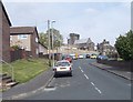
2
Site of the British Gas training centre (2)
The building Image was demolished during 2021. I don't know if there is already a plan for the redevelopment of the site.
Image: © Stephen Craven
Taken: 23 Oct 2021
0.05 miles
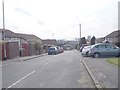
4
Holdforth Place - looking towards Oak Road
Image: © Betty Longbottom
Taken: 7 May 2012
0.06 miles