IMAGES TAKEN NEAR TO
Barnet Road, LEEDS, LS12 1QN
Introduction
This page details the photographs taken nearby to Barnet Road, LS12 1QN by members of the Geograph project.
The Geograph project started in 2005 with the aim of publishing, organising and preserving representative images for every square kilometre of Great Britain, Ireland and the Isle of Man.

There are currently over 7.5m images from over14,400 individuals and you can help contribute to the project by visiting https://www.geograph.org.uk
Image Map
Images are licensed for reuse under creativecommons.org/licenses/by-sa/2.0
Notes
- Clicking on the map will re-center to the selected point.
- The higher the marker number, the further away the image location is from the centre of the postcode.
Image Listing (194 Images Found)
Images are licensed for reuse under creativecommons.org/licenses/by-sa/2.0
Image
Details
Distance
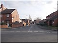
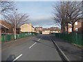
2
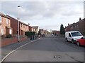
Middle Cross Street - viewed from Barnet Street
Image: © Betty Longbottom
Taken: 10 Jan 2012
0.04 miles
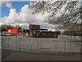
4
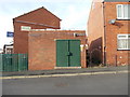
Electricity Substation No 2068 - Armley Grove Place
Image: © Betty Longbottom
Taken: 10 Jan 2012
0.06 miles
5
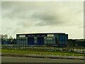
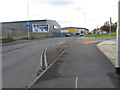
Tires4Less, Amberley Road, Armley
Part of a small business park occupying the site of a former woollen mill.
Image: © Stephen Craven
Taken: 17 Jan 2021
0.07 miles
7
St Bartholomew's primary school, Armley
A Church of England school.
Image: © Stephen Craven
Taken: 30 Apr 2016
0.08 miles
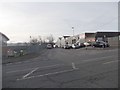
8
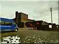
St Bartholomew's Primary School, Armley
See Image for a view from a different angle.
Image: © Stephen Craven
Taken: 17 Jan 2021
0.08 miles
10
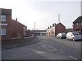
Armley Grove Place - viewed from Middle Cross Street
Image: © Betty Longbottom
Taken: 10 Jan 2012
0.09 miles