
IMAGES TAKEN NEAR TO
Whitehall, LS12 1BX
Introduction
This page details the photographs taken nearby to Whitehall, LS12 1BX by members of the Geograph project.
The Geograph project started in 2005 with the aim of publishing, organising and preserving representative images for every square kilometre of Great Britain, Ireland and the Isle of Man.

There are currently over 7.5m images from over14,400 individuals and you can help contribute to the project by visiting https://www.geograph.org.uk
Image Map
Images are licensed for reuse under creativecommons.org/licenses/by-sa/2.0
Notes
- Clicking on the map will re-center to the selected point.
- The higher the marker number, the further away the image location is from the centre of the postcode.
Image Listing (614 Images Found)
Images are licensed for reuse under creativecommons.org/licenses/by-sa/2.0
Image
Details
Distance
1
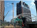
Canopy between the viaducts
When this is complete it will be a (presumably clear roofed) canopy over the triangular gap at the junction between two former railway viaducts.
Image: © Stephen Craven
Taken: 9 Jun 2023
0.01 miles
2
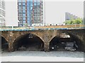
Between the viaducts
Looking from the recently converted section of Central Viaduct, which was a 'slip road' between the Great Northern Railway and Midland Railway's main lines out of Leeds, to the GNR's viaduct. Such was the density of rail lines in this area in the railway's heyday that there was another viaduct between these two, serving platforms at the GNR's Holbeck station. These arches look to have been cleared out ready for potential commercial use.
Image: © Stephen Craven
Taken: 9 Jun 2023
0.02 miles
3
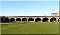
Old railway viaduct (Central Viaduct) crossing the Aire valley
Built in 1846 for the Leeds and Thirsk and Leeds Dewsbury and Manchester Railways, it was one of the earliest railways in Leeds and the viaduct represents one of just a couple of examples of the work of the engineer Thomas Grainger outside Scotland. The line was closed when Leeds Central Station was closed in 1967. Much of the viaduct was demolished, the surviving section includes the large arches over the River Aire and the Leeds and Liverpool Canal, and a series of smaller arches west of the canal (this view). This remaining section is Listed Grade II.
Image: © Alan Murray-Rust
Taken: 11 Dec 2017
0.03 miles
4
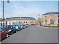
Graingers Way - looking towards Wellington Road
Image: © Betty Longbottom
Taken: 7 May 2012
0.04 miles
5
Disused Railway Viaduct
Another disused railway viaduct in the small area around the triangle junction.
Image: © Ashley Dace
Taken: 9 Oct 2010
0.04 miles
6
St Ann's Ing Lock
Over the Leeds and Liverpool Canal
Image: © Mark Morton
Taken: 12 Nov 2005
0.04 miles
7
New blocks going up on Graingers Way
The scale of a new high-rise development at the end of Graingers Way can be judged from this photo taken from Whitehall Road.
Image: © Stephen Craven
Taken: 8 Jun 2021
0.05 miles
8
Central Viaduct, Leeds, viewed from a passing Train
Image: © Stephen Armstrong
Taken: 26 Feb 2019
0.05 miles
9
Freight at Whitehall Junction
Whitehall Junction is a notorious flat railway junction to the west of Leeds station. Whenever a freight train needs to cross it to get from south of the city onto the main line towards Skipton and Carlisle, all other trains into and out of the station have to be halted, as was the one I was on at the time.
Image: © Stephen Craven
Taken: 27 Nov 2015
0.05 miles
10
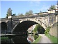
Line of Dismantled Railway over Leeds & Liverpool Canal
Image: © Betty Longbottom
Taken: 13 Oct 2010
0.06 miles