
IMAGES TAKEN NEAR TO
Raylands Way, LEEDS, LS10 4AH
Introduction
This page details the photographs taken nearby to Raylands Way, LS10 4AH by members of the Geograph project.
The Geograph project started in 2005 with the aim of publishing, organising and preserving representative images for every square kilometre of Great Britain, Ireland and the Isle of Man.

There are currently over 7.5m images from over14,400 individuals and you can help contribute to the project by visiting https://www.geograph.org.uk
Image Map
Images are licensed for reuse under creativecommons.org/licenses/by-sa/2.0
Notes
- Clicking on the map will re-center to the selected point.
- The higher the marker number, the further away the image location is from the centre of the postcode.
Image Listing (74 Images Found)
Images are licensed for reuse under creativecommons.org/licenses/by-sa/2.0
Image
Details
Distance
1
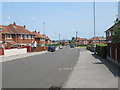
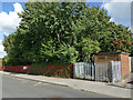
Raylands Way - viewed from Cranmore Rise
Image: © Betty Longbottom
Taken: 5 Jul 2013
0.01 miles
4
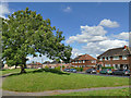
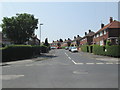
Houses on Throstle Road North
The history of development here appear to be that when Belle Isle was first developed in the 1920s, a section of what was intended to be a dual carriageway ring road was built up to the city boundary a little way east of here. That never materialised and only the northern carriageway of the road now carries on over the former city boundary; this southern short section of what had been "Ring Road Middleton" is now named "Throstle Road North". The wide central reservation makes a pleasant traffic-free pedestrian route.
Image: © Stephen Craven
Taken: 2 Aug 2020
0.04 miles
7
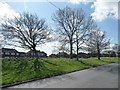
Trees in the middle of the ring road, Belle Isle
The central reservation has been widened, and squeezed the road into two narrow and distant roadways.
Image: © Christine Johnstone
Taken: 5 Apr 2012
0.06 miles
8
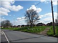
Spring on the ring road, Belle Isle
The road hugs the northern edge of the space once allocated to it, leaving a wide grassy area in the middle.
Image: © Christine Johnstone
Taken: 5 Apr 2012
0.08 miles
9
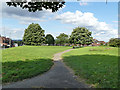
Central reservation of an abortive ring road
The history of development here appear to be that when Belle Isle was first developed in the 1920s, a section of what was intended to be a dual carriageway ring road was built up to the city boundary a little way east of here. That never materialised and only the northern carriageway of the road now carries on over the former city boundary; the southern short section of what had been "Ring Road Middleton" is now named "Throstle Road North". The wide central reservation makes a pleasant traffic-free pedestrian route.
Image: © Stephen Craven
Taken: 2 Aug 2020
0.09 miles
10
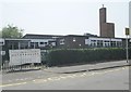
Cranmore Primary School - Cranmore Drive
Image: © Betty Longbottom
Taken: 5 Jul 2013
0.09 miles