
IMAGES TAKEN NEAR TO
Landing Place, LS10 1FA
Introduction
This page details the photographs taken nearby to Landing Place, LS10 1FA by members of the Geograph project.
The Geograph project started in 2005 with the aim of publishing, organising and preserving representative images for every square kilometre of Great Britain, Ireland and the Isle of Man.

There are currently over 7.5m images from over14,400 individuals and you can help contribute to the project by visiting https://www.geograph.org.uk
Image Map
Images are licensed for reuse under creativecommons.org/licenses/by-sa/2.0
Notes
- Clicking on the map will re-center to the selected point.
- The higher the marker number, the further away the image location is from the centre of the postcode.
Image Listing (257 Images Found)
Images are licensed for reuse under creativecommons.org/licenses/by-sa/2.0
Image
Details
Distance
1
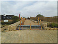
CITU - approach to the bridge
As well as the steps there is a ramp round to the right.
Image: © Stephen Craven
Taken: 17 Jun 2020
0.01 miles
2
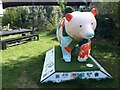
Clarence the Climate Bear
This one was found in the beer garden of the Piglove Bar, part of the CITU development.
Image: © Stephen Craven
Taken: 9 Sep 2023
0.01 miles
3
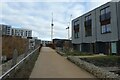
Citu Bridge
Crossing the River Aire and connecting new housing developments.
Image: © DS Pugh
Taken: 11 Feb 2023
0.02 miles
4
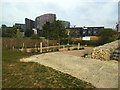
CITU - ramp to the bridge
A zig-zag access ramp from the existing riverside path (Trans-Pennine Trail) to the new cycle and pedestrian bridge.
Image: © Stephen Craven
Taken: 17 Jun 2020
0.02 miles
5
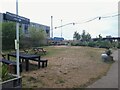
Piglove Brewery, CITU Leeds
The facility, which may only be temporary until the CITU development continues in this area, consists of a 'pop up tap room' in a modular building, with a few benches on the grass outside.
Image: © Stephen Craven
Taken: 17 Jun 2023
0.02 miles
6
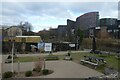
Park near Citu Bridge
A little park beside the River Aire in an area of Leeds undergoing extensive regeneration.
Image: © DS Pugh
Taken: 11 Feb 2023
0.02 miles
7
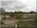
Site of the former Leeds steel works (2)
This has been a derelict site for a long time; even the 1938 6-inch map shows it as "Iron and steel works (disused)". For a history of the Leeds Steel Works, see http://www.gracesguide.co.uk/1912_Iron_and_Steel_Institute:_Visits_to_Works#Leeds_Steel_Works.
Image: © Stephen Craven
Taken: 29 Oct 2016
0.02 miles
8

What's behind the brick wall?
Image: © Stephen Craven
Taken: 29 Oct 2016
0.03 miles
9
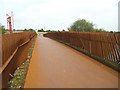
CITU - river bridge, detail
The parapets of the bridge are made from plates of cor-ten steel arranged in a wavy fashion, not unlike that of the Knowsthorpe bridge a little further downriver Image
Image: © Stephen Craven
Taken: 17 Jun 2020
0.03 miles
10
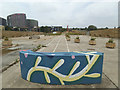
CITU development site, south bank
Work has yet to start on construction this side of the river, but the space is already in use as an approach to the new bridge.
Image: © Stephen Craven
Taken: 17 Jun 2020
0.03 miles