IMAGES TAKEN NEAR TO
High Toynton, HORNCASTLE, LN9 6NP
Introduction
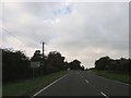
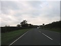
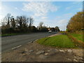
This page details the photographs taken nearby to LN9 6NP by members of the Geograph project.
The Geograph project started in 2005 with the aim of publishing, organising and preserving representative images for every square kilometre of Great Britain, Ireland and the Isle of Man.

There are currently over 7.5m images from over14,400 individuals and you can help contribute to the project by visiting https://www.geograph.org.uk
Image Map
Images are licensed for reuse under creativecommons.org/licenses/by-sa/2.0
Notes
- Clicking on the map will re-center to the selected point.
- The higher the marker number, the further away the image location is from the centre of the postcode.
Image Listing (47 Images Found)
Images are licensed for reuse under creativecommons.org/licenses/by-sa/2.0
Image
Details
Distance
7
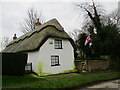
The Thatched Cottage, High Toynton
Dates from the late eighteenth century https://historicengland.org.uk/listing/the-list/list-entry/1168167?section=official-listing Of mud and stud construction.
Image: © Jonathan Thacker
Taken: 3 Feb 2022
0.19 miles
9
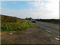
Field entrance with poppies, by the lay-by on Tetford Road
Image: © Chris
Taken: 13 Jul 2014
0.20 miles