IMAGES TAKEN NEAR TO
Thimbleby, HORNCASTLE, LN9 5RH
Introduction
This page details the photographs taken nearby to LN9 5RH by members of the Geograph project.
The Geograph project started in 2005 with the aim of publishing, organising and preserving representative images for every square kilometre of Great Britain, Ireland and the Isle of Man.

There are currently over 7.5m images from over14,400 individuals and you can help contribute to the project by visiting https://www.geograph.org.uk
Image Map
Images are licensed for reuse under creativecommons.org/licenses/by-sa/2.0
Notes
- Clicking on the map will re-center to the selected point.
- The higher the marker number, the further away the image location is from the centre of the postcode.
Image Listing (11 Images Found)
Images are licensed for reuse under creativecommons.org/licenses/by-sa/2.0
Image
Details
Distance
1
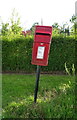
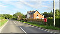
Elizabeth II postbox on the B1190, Dear's Houses
Postbox No. LN9 452.
See Image] for context.
Image: © JThomas
Taken: 17 Jul 2020
0.02 miles
2
B1190, Dear's Houses
Showing position of Postbox No. LN9 452.
See Image] for postbox.
Image: © JThomas
Taken: 17 Jul 2020
0.02 miles
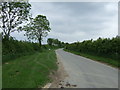
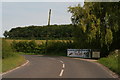
3
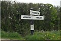
Direction Sign – Signpost on the B1190 Horncastle Road in Thimbleby parish
Located on the east side of the T junction of the B1190 Horncastle Road and Hungram Lane, in Thimbleby parish. 3 arms but no finial. This fingerpost has now been refurbished, see https://www.geograph.org.uk/photo/7952218.
Milestone Society National ID: LI_TF2270A
Image: © A Riley
Taken: 19 Apr 2022
0.06 miles
4
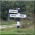
Direction Sign – Signpost on the B1190 Horncastle Road in Thimbleby parish
Located on the east side of the T junction of the B1190 Horncastle Road and Hungram Lane, in Thimbleby parish. 3 arms but no finial. Refurbished since https://www.geograph.org.uk/photo/7158727.
Milestone Society National ID: LI_TF2270A
Image: © A Riley
Taken: 22 Sep 2024
0.06 miles
5
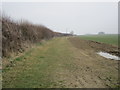
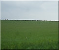
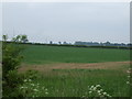
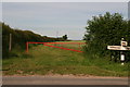
Bridleway to the A158
Appears to have been part of a longer route running from the direction of the River Witham into the Lincolnshire Wolds. Much of this route is part of the public road system but this has only the status of a bridleway.
Image: © Jonathan Thacker
Taken: 18 Mar 2015
0.08 miles
7
At the sign of the leaping dog: Thimbleby Kennels
Image: © Chris
Taken: 19 Jun 2014
0.13 miles