IMAGES TAKEN NEAR TO
Goltho, MARKET RASEN, LN8 5JD
Introduction
This page details the photographs taken nearby to LN8 5JD by members of the Geograph project.
The Geograph project started in 2005 with the aim of publishing, organising and preserving representative images for every square kilometre of Great Britain, Ireland and the Isle of Man.

There are currently over 7.5m images from over14,400 individuals and you can help contribute to the project by visiting https://www.geograph.org.uk
Image Map (Loading...)


Getting Data...Please wait
Leaflet Map data © OpenStreetMap
Images are licensed for reuse under creativecommons.org/licenses/by-sa/2.0
Notes
- Clicking on the map will re-center to the selected point.
- The higher the marker number, the further away the image location is from the centre of the postcode.
Image Listing (11 Images Found)
Images are licensed for reuse under creativecommons.org/licenses/by-sa/2.0
Image
Details
Distance
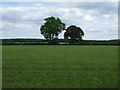
1
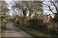
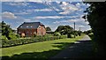
Lane past Shepherds Farm, Goltho
The village of Goltho Image has disappeared.
Image: © Alan Murray-Rust
Taken: 4 Feb 2007
0.02 miles
2
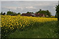
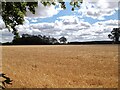
Is it a mirage? Bungalow glimpsed across a sea of yellow
Nicely camouflaged, this building doesn't seem to be marked on the map.
Image: © Chris
Taken: 22 May 2016
0.03 miles
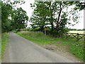
4
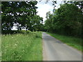
Minor road towards Wragby
Heading north east near Shpherd's Farm.
Image: © JThomas
Taken: 15 Jun 2015
0.08 miles
6
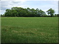
Farmland and woodland
Near Shepherd's Farm.
Image: © JThomas
Taken: 15 Jun 2015
0.13 miles
7
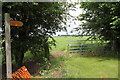
Lane to Apley and Footpath to Goltho Chapel
The lane just clips the square here.
A lost medieval village dating back to Saxon times, Goltho probably means "The place where the Marigolds grow". That the 40-acre site once represented one of the best examples of a clay-land mediaeval village in the East Midlands and the size of the sunken roads, some 40 feet wide and 5 feet deep, saved the site from the plough for over 500 years. Thanks to Templar on www.qype.co.uk/place/223548-Goltho-Deserted-Village-Lincoln
Image: © J.Hannan-Briggs
Taken: 17 Jul 2011
0.16 miles
9
House next to Shepherd's Farm Cottages, near Wragby
The ground floor brickwork and arch over the front door may suggest an earlier date of construction than that of the Dutch barn type first floor and roof area.
Image: © Chris Morgan
Taken: 14 Jul 2014
0.19 miles
10
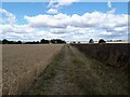
Field track to the medieval village of Goltho
Image: © David Brown
Taken: 5 Aug 2022
0.21 miles