IMAGES TAKEN NEAR TO
Olsen Rise, LINCOLN, LN2 4ZE
Introduction
This page details the photographs taken nearby to Olsen Rise, LN2 4ZE by members of the Geograph project.
The Geograph project started in 2005 with the aim of publishing, organising and preserving representative images for every square kilometre of Great Britain, Ireland and the Isle of Man.

There are currently over 7.5m images from over14,400 individuals and you can help contribute to the project by visiting https://www.geograph.org.uk
Image Map (Loading...)


Getting Data...Please wait
Leaflet Map data © OpenStreetMap
Images are licensed for reuse under creativecommons.org/licenses/by-sa/2.0
Notes
- Clicking on the map will re-center to the selected point.
- The higher the marker number, the further away the image location is from the centre of the postcode.
Image Listing (26 Images Found)
Images are licensed for reuse under creativecommons.org/licenses/by-sa/2.0
Image
Details
Distance
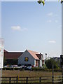
1
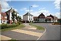
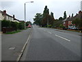
Carlton Boulevard
New homes on Carlton Boulevard off Outer Circle Road
Image: © Richard Croft
Taken: 26 Jun 2008
0.03 miles
2
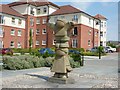
Olsen Court
Sculpture on Olsen Court with Palaine House behind
Image: © Richard Croft
Taken: 11 Aug 2012
0.03 miles
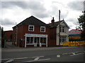
4
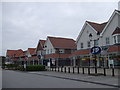
Carlton Mews
Retail premises and housing at the Carlton Centre
Image: © Richard Croft
Taken: 14 May 2022
0.06 miles
7
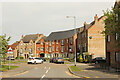
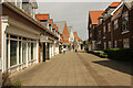
Venables Way
Town houses on Venables Way
Image: © Richard Croft
Taken: 14 May 2022
0.12 miles
8
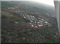
Wragby Road into Lincoln: aerial 2017
Greetwell Hollow top left. Outer Circle ring road and industrial estate by the red roofed building.
Image: © Chris
Taken: 9 Dec 2017
0.13 miles
10
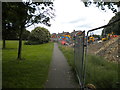
Footpath to Wolsey Way, Glebe Park
Providing a means for pedestrians to cut off a corner when walking from Bunkers Hill (behind the photographer) into Wolsey Way, the south end of which is closed as part of a junction rebuilding project.
Image: © Richard Vince
Taken: 16 Jun 2018
0.13 miles