
IMAGES TAKEN NEAR TO
Upper Baptist Street, HOLYHEAD, LL65 1SH
Introduction
This page details the photographs taken nearby to Upper Baptist Street, LL65 1SH by members of the Geograph project.
The Geograph project started in 2005 with the aim of publishing, organising and preserving representative images for every square kilometre of Great Britain, Ireland and the Isle of Man.

There are currently over 7.5m images from over14,400 individuals and you can help contribute to the project by visiting https://www.geograph.org.uk
Image Map
Images are licensed for reuse under creativecommons.org/licenses/by-sa/2.0
Notes
- Clicking on the map will re-center to the selected point.
- The higher the marker number, the further away the image location is from the centre of the postcode.
Image Listing (341 Images Found)
Images are licensed for reuse under creativecommons.org/licenses/by-sa/2.0
Image
Details
Distance
1
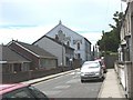
Bethel Welsh Baptist Chapel, Edmund Street
The Baptist cause in Holyhead was established in 1790 and the first chapel built in 1809. The present chapel, which cost £2500 to build, dates from 1895. There is a small cemetery in the rear of the chapel.
Image: © Eric Jones
Taken: 4 Jul 2008
0.04 miles
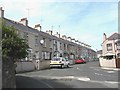
3
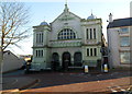
Grade II listed Tabernacl Chapel, Holyhead
The chapel, on the corner of Upper Baptist Street and Thomas Street, is one of several large chapels in Holyhead. It is a 1913 rebuild of the original, dating from in 1823, and enlarged twice in later decades of the 19th century. Grade II listed in July 1994.
Image: © Jaggery
Taken: 26 Mar 2012
0.06 miles
4
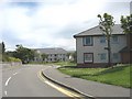
Llys Mair Sheltered Accommodation on the site of the former Bon Sauveur Convent
Llys Mair means "Mary's Court".
Image: © Eric Jones
Taken: 4 Jul 2008
0.06 miles
5
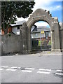
The gate to the former Holyhead Convent
Within the walls of the convent was a school Le Bon Sauveur - a castle-like structure which dominated the view of the town from the sea. The convent, occupied by a French order of nuns closed in 1983 and it and the school buildings were demolished in 1988. The site is now largely occupied by sheltered accommodation for the elderly, while the chapel has become the Ucheldre Centre.
www.bbc.co.uk/wales/northwest/sites/holyhead/pages/bon_sauveur.shtml
Image: © Eric Jones
Taken: 4 Jul 2008
0.06 miles
6
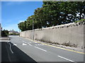
The Convent Wall
The wall, the gate and the chapel are all that remain of the Holyhead Bon Sauveur Convent. However, a small group of sisters from the order still serve the community.
Image: © Eric Jones
Taken: 4 Jul 2008
0.08 miles
7
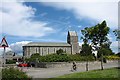
The Ucheldre Arts Centre at the former Good Saviour Convent chapel
www.ucheldre.org/ -
Image: © Eric Jones
Taken: 4 Jul 2008
0.08 miles
8
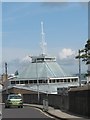
The dome of St Mary's Catholic Church with the smoking funnel of the Ulysses in the background
This view was taken from Longford Street.
Image: © Eric Jones
Taken: 24 Jul 2009
0.09 miles
9
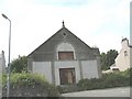
The disused Capel Gwynfa, Longford Road
This chapel was built by the Wesleyans in 1888. It closed in 1960 but was used for a while as a Salvationist Citadel. Later, it became a garage. It now appears to be disused.
Image: © Eric Jones
Taken: 21 Jul 2008
0.09 miles
10
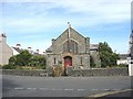
English Wesleyan Methodist Church, Longford Road
Image: © Eric Jones
Taken: 21 Jul 2008
0.10 miles