IMAGES TAKEN NEAR TO
Bryntirion, BEAUMARIS, LL58 8HB
Introduction
This page details the photographs taken nearby to Bryntirion, LL58 8HB by members of the Geograph project.
The Geograph project started in 2005 with the aim of publishing, organising and preserving representative images for every square kilometre of Great Britain, Ireland and the Isle of Man.

There are currently over 7.5m images from over14,400 individuals and you can help contribute to the project by visiting https://www.geograph.org.uk
Image Map
Images are licensed for reuse under creativecommons.org/licenses/by-sa/2.0
Notes
- Clicking on the map will re-center to the selected point.
- The higher the marker number, the further away the image location is from the centre of the postcode.
Image Listing (261 Images Found)
Images are licensed for reuse under creativecommons.org/licenses/by-sa/2.0
Image
Details
Distance
1
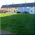
Houses on the south side of Maes Hyfryd, Beaumaris
The row of houses is set back 30 metres from the road.
Image: © Jaggery
Taken: 27 Mar 2012
0.07 miles
2
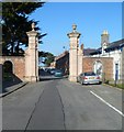
Grade II listed gate piers at SW end of Stanley Street, Beaumaris
Viewed from Maes Hyfryd. The gate piers, Grade II listed in September 1950, were originally part of the now-abandoned Baron Hill mansion.
Image: © Jaggery
Taken: 27 Mar 2012
0.07 miles

6
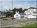
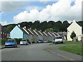
Houses in the Mill Lane area
The bridge on the right is known as Townsend Bridge. It spans Nant-y-Felin which got its name because it was utilized to work the town's corn mill.
Image: © Eric Jones
Taken: 24 Sep 2008
0.08 miles
8
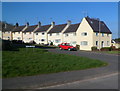
Ffordd Meigan houses, Beaumaris
Viewed from Maes Hyfryd.
Image: © Jaggery
Taken: 27 Mar 2012
0.09 miles
9
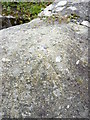
Rivet benchmark on top of post, Beaumaris
This rivet benchmark is located on the top of a post on the SE side of the road in Beaumaris & it is shown in the current Ordnance Survey database at a height of 5.7264m above the Newlyn datum.
Image: © Meirion
Taken: 9 Sep 2011
0.09 miles