IMAGES TAKEN NEAR TO
Talybont, BANGOR, LL57 3YD
Introduction
This page details the photographs taken nearby to LL57 3YD by members of the Geograph project.
The Geograph project started in 2005 with the aim of publishing, organising and preserving representative images for every square kilometre of Great Britain, Ireland and the Isle of Man.

There are currently over 7.5m images from over14,400 individuals and you can help contribute to the project by visiting https://www.geograph.org.uk
Image Map
Images are licensed for reuse under creativecommons.org/licenses/by-sa/2.0
Notes
- Clicking on the map will re-center to the selected point.
- The higher the marker number, the further away the image location is from the centre of the postcode.
Image Listing (15 Images Found)
Images are licensed for reuse under creativecommons.org/licenses/by-sa/2.0
Image
Details
Distance
1
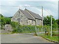
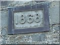
Tal-y-bont old chapel
Situated on the Ponc-y-lon adjacent to the A55. Dated 1868.
Image: © Jonathan Billinger
Taken: 30 Jun 2009
0.09 miles
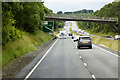
2
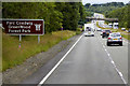
North Wales Expressway, Westbound near Tal-y-Bont
Image: © David Dixon
Taken: 16 Jun 2018
0.09 miles
3
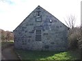
Mission Room, Tal-y-bont
Dated 1868. See also Image
Image: © Meirion
Taken: 20 Mar 2019
0.09 miles
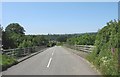
5
Bridge over the Westbound A55 near Tal-y-Bont
Image: © David Dixon
Taken: 16 Jun 2018
0.16 miles
6
The A55 overbridge south of Tal-y-bont
This is the only straight and wide section of this notoriously narrow and winding lane leading to Llanllechid and Rachub which is used by the Arriva No 66 service.
Image: © Eric Jones
Taken: 31 May 2008
0.17 miles
7
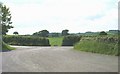
A road junction and a sharp bend on the approach to the A55 overbridge
Image: © Eric Jones
Taken: 31 May 2008
0.17 miles
9
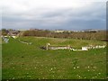
Part of the Tal-y-bont Flood Relief Scheme
Image: © Chris Andrews
Taken: 15 Feb 2017
0.19 miles
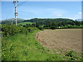
10
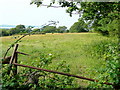
Grassland near Plas Maes-y-groes
Looking north with the glint of the Strait with Anglesey beyond.
Image: © Jonathan Billinger
Taken: 30 Jun 2009
0.20 miles