
IMAGES TAKEN NEAR TO
Trem Eilian, CAERNARFON, LL55 3PT
Introduction
This page details the photographs taken nearby to Trem Eilian, LL55 3PT by members of the Geograph project.
The Geograph project started in 2005 with the aim of publishing, organising and preserving representative images for every square kilometre of Great Britain, Ireland and the Isle of Man.

There are currently over 7.5m images from over14,400 individuals and you can help contribute to the project by visiting https://www.geograph.org.uk
Image Map
Images are licensed for reuse under creativecommons.org/licenses/by-sa/2.0
Notes
- Clicking on the map will re-center to the selected point.
- The higher the marker number, the further away the image location is from the centre of the postcode.
Image Listing (18 Images Found)
Images are licensed for reuse under creativecommons.org/licenses/by-sa/2.0
Image
Details
Distance
1
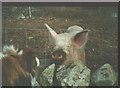
Paddy and the Pig
The practice of keeping pigs, very common in the past, has decreased as small holdings have become equine based mini-ranches. Here, at Cytir, was one of the last places to keep pigs. By today, the muddy pig field has become an ornamental garden, no doubt much to the relief of the residents of the nearby executive type housing estate.
Image: © Eric Jones
Taken: 3 May 2000
0.08 miles

5
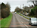
A4244 near Llys Farm
Close to Snowdon Caravan Park
Image: © John Firth
Taken: 16 Sep 2019
0.15 miles
6
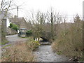
Afon Caledffrwd at Pont Brynrefail
Up to the late 1960s, and the building of a new sewage works for the Deiniolen area, this river used to be a disgusting open sewer. The Caledffrwd flows into Afon Rhythallt.
Image: © Eric Jones
Taken: 17 Feb 2007
0.16 miles

8

Rivet benchmark on Pont Brynrefail, Brynrefail
This rivet benchmark is located on the SW parapet of Pont Brynrefail in Brynrefail and it is shown in the current Ordnance Survey database at a height of 111.2429m above the Newlyn datum.
Image: © Meirion
Taken: 8 Feb 2012
0.18 miles
9
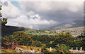
View towards Coed Cae Coch woods from Lon Cytir
The village in the background is Deiniolen.
Image: © Eric Jones
Taken: 4 Jul 1997
0.19 miles
10
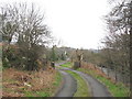
Cattle grid on the lane from Pant Buarth
Image: © Eric Jones
Taken: 17 Feb 2007
0.20 miles