
IMAGES TAKEN NEAR TO
Clwt-y-Bont, CAERNARFON, LL55 3DW
Introduction
This page details the photographs taken nearby to LL55 3DW by members of the Geograph project.
The Geograph project started in 2005 with the aim of publishing, organising and preserving representative images for every square kilometre of Great Britain, Ireland and the Isle of Man.

There are currently over 7.5m images from over14,400 individuals and you can help contribute to the project by visiting https://www.geograph.org.uk
Image Map
Images are licensed for reuse under creativecommons.org/licenses/by-sa/2.0
Notes
- Clicking on the map will re-center to the selected point.
- The higher the marker number, the further away the image location is from the centre of the postcode.
Image Listing (39 Images Found)
Images are licensed for reuse under creativecommons.org/licenses/by-sa/2.0
Image
Details
Distance
1
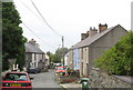
Caledffrwd Terrace, Clwt y Bont
Clwt y Bont was far less a planned village than Deiniolen.
Image: © Eric Jones
Taken: 21 Sep 2006
0.04 miles
2
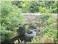
The Dinorwig Tramway Bridge at Clwt y Bont
The tramway crossed the Afon Caledffrwd at Clwt y Bont. The main axis of this once separate village, long since merged with Deiniolen, follows the line of the old tramway. The bridge is built of waste slate.
Image: © Eric Jones
Taken: 21 Sep 2006
0.05 miles
4
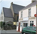
Post Office and Shop, Clwt y Bont
This sub-post office and newsagents is the only shop left in Clwt y Bont. Next door is Libanys (sic) Chapel. Libanus, and its sister chapel, Sardis, at Dinorwig - literally the highest chapel in England and Wales - come under the wing of Penuel Chapel, Bangor Image Penuel has a Welsh language site which deals with Libanus and Sardis under the title' Eglwysi eraill yr Ofalaeth' (other churches within the pastorate). http://www.penuelbangor.co.uk
Image: © Eric Jones
Taken: 21 Sep 2006
0.09 miles
5
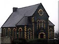
Libanys Chapel in Deiniolen
Libanys Chapel in the village of Deiniolen dates back to 1877
Image: © Nigel Williams
Taken: 12 Feb 2006
0.09 miles
6
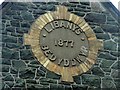
Libanys Chapel - detail of the chapel name
The name Libanus is often used as a chapel name, this chapel has an unusual spelling with a Y replacing the usual U as seen in this detail shot of the chapel front
Image: © Nigel Williams
Taken: 15 Aug 2006
0.12 miles
7
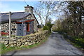
Minor Road
Minor road at Clwt-y-Bont, Gwynedd.
Image: © Keith Evans
Taken: 30 Apr 2016
0.14 miles
8
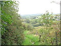
The Lower Incline of the 1824 Dinorwig Tramway
This is the lowest of two elaborately engineered inclines on the 2ft gauge horse-drawn Dinorwig tramway which linked Dinorwig Slate Quarry with the port of Felinheli (Port Dinorwig) on the Menai Strait. The tramway was not a great success and, in 1842, was replaced by the Padarn Railway which operated until the 1960s. Deiniolen can be partly seen through the bushes.
Image: © Eric Jones
Taken: 21 Sep 2006
0.14 miles
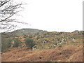
10
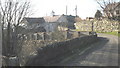
Cwt Band Deiniolen Bandroom
Deiniolen Silver Band, one of Wales' premier brass bands, began life as a quarry band in 1835. Until recently, every quarrying village had its own band and throughout the decades there was great rivalry between the various bands. The bandroom is sited in a former slate mill. The band has an excellent bilingual web site:
http://www.deiniolenband.org.uk
Image: © Eric Jones
Taken: 17 Feb 2008
0.15 miles