
IMAGES TAKEN NEAR TO
Groeslon, CAERNARFON, LL54 7UD
Introduction
This page details the photographs taken nearby to LL54 7UD by members of the Geograph project.
The Geograph project started in 2005 with the aim of publishing, organising and preserving representative images for every square kilometre of Great Britain, Ireland and the Isle of Man.

There are currently over 7.5m images from over14,400 individuals and you can help contribute to the project by visiting https://www.geograph.org.uk
Image Map
Images are licensed for reuse under creativecommons.org/licenses/by-sa/2.0
Notes
- Clicking on the map will re-center to the selected point.
- The higher the marker number, the further away the image location is from the centre of the postcode.
Image Listing (14 Images Found)
Images are licensed for reuse under creativecommons.org/licenses/by-sa/2.0
Image
Details
Distance
1
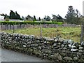
Contrasting field boundaries at the edge of Groeslon
Rounded rocks make a drystone wall by the road. Wire and sheets of slate make a fence by the hedge.
Image: © Christine Johnstone
Taken: 17 Nov 2013
0.07 miles
2
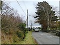
The road to Carmel
Heading eastwards and upwards from Groeslon.
Image: © Christine Johnstone
Taken: 17 Nov 2013
0.08 miles
3
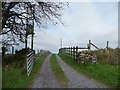
Track to Bryn Hafod and Tyddyn Mawr
In English, the house names could be Summer Farm Hill and Great Farmstead.
Image: © Christine Johnstone
Taken: 17 Nov 2013
0.10 miles
4
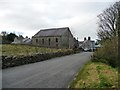
Brynrhos Chapel at the eastern edge of Groeslon
A Calvanistic Methodist chapel, founded in 1880. The ornate building just visible beyond is the former schoolroom.
Image: © Christine Johnstone
Taken: 17 Nov 2013
0.10 miles
5
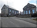
Brynrhos Chapel and Schoolroom
Brynrhos was a Congregational chapel which has now been converted into a house.
Image: © Eirian Evans
Taken: 29 Mar 2018
0.11 miles
6
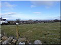
View north from Groeslon
Looking north, the Menai Straits are seen clearly, and Anglesey beyond
Image: © Eirian Evans
Taken: 29 Mar 2018
0.14 miles
7
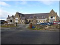
Former primary school at Groeslon
Converted into housing, the children now go to Ysgol Bro Llifon, a new school nearer the centre of the village
Image: © Eirian Evans
Taken: 29 Mar 2018
0.15 miles
8
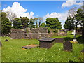
The Remains of St Thomas's Church, Groeslon
Built in the mid nineteenth century and now demolished.
Image: © Chris Andrews
Taken: 14 May 2017
0.17 miles
9
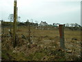
Farmland near Groeslon
The fence posts are made of slate - there is plenty of this available in the area.
Image: © David Medcalf
Taken: 23 Mar 2006
0.18 miles
10
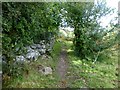
Footpath Starts Well
Our footpath started well on our route from the north towards the Caernarvon Fundamental Benchmark however we were soon in trouble when it became badly overgrown and a detour was required. It all looked so easy on the map.
Image: © Rude Health
Taken: 13 Sep 2015
0.19 miles