IMAGES TAKEN NEAR TO
Rhosgadfan, CAERNARFON, LL54 7LE
Introduction
This page details the photographs taken nearby to LL54 7LE by members of the Geograph project.
The Geograph project started in 2005 with the aim of publishing, organising and preserving representative images for every square kilometre of Great Britain, Ireland and the Isle of Man.

There are currently over 7.5m images from over14,400 individuals and you can help contribute to the project by visiting https://www.geograph.org.uk
Image Map
Images are licensed for reuse under creativecommons.org/licenses/by-sa/2.0
Notes
- Clicking on the map will re-center to the selected point.
- The higher the marker number, the further away the image location is from the centre of the postcode.
Image Listing (5 Images Found)
Images are licensed for reuse under creativecommons.org/licenses/by-sa/2.0
Image
Details
Distance
1
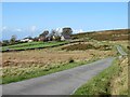
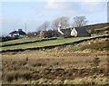
Near the road end above Rhosgadfan
The public road extends as far as Hafod Ruffydd Farm, which is seen in the distance.
Image: © Gordon Hatton
Taken: 26 Sep 2023
0.17 miles
2
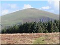
Waymarker post on the moor
The post marks the line of the Snowdonia Slate Trail which crosses at right angles here. Ahead, beyond the forest and valley, is the bulk of Moel Eilio at 726m
Image: © Gordon Hatton
Taken: 26 Sep 2023
0.19 miles
3
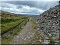
A good track between the stream and the slate tip
Image: © David Medcalf
Taken: 29 Aug 2020
0.22 miles
4
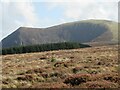
Across a soggy moor towards Mynydd Mawr
There should be a path here somewhere, but after recent rains it seemed easier just to follow the driest ground. Ahead is the bulk of Mynydd Mawr and its steep northern flank which is Cwm Du.
Image: © Gordon Hatton
Taken: 26 Sep 2023
0.22 miles