
IMAGES TAKEN NEAR TO
Market Place, CAERNARFON, LL54 6NN
Introduction
This page details the photographs taken nearby to Market Place, LL54 6NN by members of the Geograph project.
The Geograph project started in 2005 with the aim of publishing, organising and preserving representative images for every square kilometre of Great Britain, Ireland and the Isle of Man.

There are currently over 7.5m images from over14,400 individuals and you can help contribute to the project by visiting https://www.geograph.org.uk
Image Map
Images are licensed for reuse under creativecommons.org/licenses/by-sa/2.0
Notes
- Clicking on the map will re-center to the selected point.
- The higher the marker number, the further away the image location is from the centre of the postcode.
Image Listing (77 Images Found)
Images are licensed for reuse under creativecommons.org/licenses/by-sa/2.0
Image
Details
Distance
1
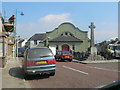
Memorial Hall and War Memorial, Penygroes
Image: © Eirian Evans
Taken: 9 Apr 2013
0.01 miles
2
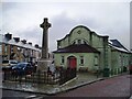
War Memorial and Neuadd Coffa, Penygroes
Image: © Chris Andrews
Taken: 5 May 2023
0.01 miles
3
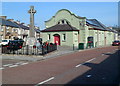
War Memorial and Memorial Hall, Penygroes
Located in Market Place (Maes-y-Farchnad in Welsh), the War Memorial is a Celtic cross on a plinth inside a fence lined with red dragons. The inscription on the building is NEUADD GOFFA, Welsh for Memorial Hall.
Image: © Jaggery
Taken: 24 Mar 2012
0.02 miles
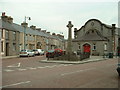
5
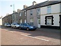
Inconspicuous name sign, Market Place, Penygroes
Above the window behind the car on the right is JEWELLERS & SILVERSMITHS.
Above the door is Est(ablished) 1857 J THOMAS & SONS.
Image: © Jaggery
Taken: 24 Mar 2012
0.03 miles
6
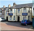
Goat, Penygroes
The wall shows the Station Road pub's Welsh name Yr Afr and the English Goat.
There wasn't enough space, it seems, for The Goat. The pub sign http://www.geograph.org.uk/photo/3462029 shows only Yr Afr.
Image: © Jaggery
Taken: 24 Mar 2012
0.04 miles
7
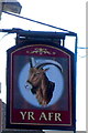
Yr Afr pub sign, Penygroes
The sign hangs from a bracket here. http://www.geograph.org.uk/photo/3462025
Image: © Jaggery
Taken: 24 Mar 2012
0.04 miles
8
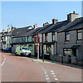
Station Road, Penygroes
Viewed from Ffordd Clynnog looking towards the Goat (Yr Afr) pub http://www.geograph.org.uk/photo/3462025 at the left edge of the view.
The name of the road was the only evidence I could find of the former Penygroes railway station, shown on old maps near the camera location. The station closed in 1964. The course of the nearby A487 uses the trackbed of the dismantled railway.
Image: © Jaggery
Taken: 24 Mar 2012
0.04 miles
9
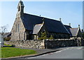
Christ Church Penygroes viewed from the south
The Church in Wales church, built in 1890, is located in a rectangular churchyard
on the corner of Lon Eglwys and Bryn Llwyn.
Image: © Jaggery
Taken: 24 Mar 2012
0.05 miles
10
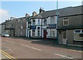
Tafarn Yr Afr, Penygroes
Public house on Market Street, Penygroes
Image: © Eirian Evans
Taken: 9 Apr 2013
0.05 miles