IMAGES TAKEN NEAR TO
Botwnnog, PWLLHELI, LL53 7SS
Introduction
This page details the photographs taken nearby to LL53 7SS by members of the Geograph project.
The Geograph project started in 2005 with the aim of publishing, organising and preserving representative images for every square kilometre of Great Britain, Ireland and the Isle of Man.

There are currently over 7.5m images from over14,400 individuals and you can help contribute to the project by visiting https://www.geograph.org.uk
Image Map (Loading...)


Getting Data...Please wait
Leaflet Map data © OpenStreetMap
Images are licensed for reuse under creativecommons.org/licenses/by-sa/2.0
Notes
- Clicking on the map will re-center to the selected point.
- The higher the marker number, the further away the image location is from the centre of the postcode.
Image Listing (15 Images Found)
Images are licensed for reuse under creativecommons.org/licenses/by-sa/2.0
Image
Details
Distance
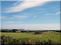
1
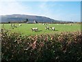
Grazing sheep near Bodrhiw
Bodrhiw house can be seen in the background.
Image: © Eric Jones
Taken: 8 Oct 2010
0.05 miles
2
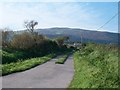
The lower end of the Rhydybengan Farm road
Image: © Eric Jones
Taken: 8 Oct 2010
0.05 miles
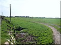
3
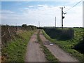
Farm access lane with public rights of way
This road provides access on foot to the cliff top.
Image: © Eric Jones
Taken: 8 Oct 2010
0.09 miles
4
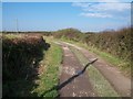
View north along the Bryn-cynan access track
Image: © Eric Jones
Taken: 8 Oct 2010
0.10 miles
6
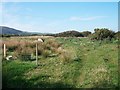
Rough track through the wetland at Rhosneigwl
Image: © Eric Jones
Taken: 8 Oct 2010
0.14 miles
7
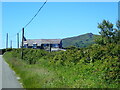
Ty Newydd Neigwl
Mynydd Rhiw on the horizon.
Image: © Eirian Evans
Taken: 13 Jun 2021
0.18 miles
8
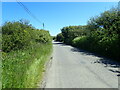
Minor road near Porth Neigwl
Heading north east towards Saithbont
Image: © Eirian Evans
Taken: 13 Jun 2021
0.18 miles
9
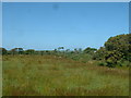
Farmland near Ty'n Rhos Neigwl
Poor quality land. Looking north, Ty'n Rhos Neigwl is just visible to the right of centre.
Image: © David Medcalf
Taken: 13 Jul 2006
0.20 miles
10
Path southwards towards Bryn-cynan
The roof of Bryn-cynan can be seen on the skyline.
Image: © Eric Jones
Taken: 8 Oct 2010
0.20 miles