
IMAGES TAKEN NEAR TO
LLWYNGWRIL, LL37 2JJ
Introduction
This page details the photographs taken nearby to LL37 2JJ by members of the Geograph project.
The Geograph project started in 2005 with the aim of publishing, organising and preserving representative images for every square kilometre of Great Britain, Ireland and the Isle of Man.

There are currently over 7.5m images from over14,400 individuals and you can help contribute to the project by visiting https://www.geograph.org.uk
Image Map
Images are licensed for reuse under creativecommons.org/licenses/by-sa/2.0
Notes
- Clicking on the map will re-center to the selected point.
- The higher the marker number, the further away the image location is from the centre of the postcode.
Image Listing (25 Images Found)
Images are licensed for reuse under creativecommons.org/licenses/by-sa/2.0
Image
Details
Distance
1
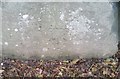
Ordnance Survey Cut Mark
This OS cut mark can be found on the wall of Garth Y Mor. It marks a point 23.389m above mean sea level.
Image: © Adrian Dust
Taken: 18 Feb 2018
0.04 miles
2
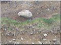
Oystercatcher and boulder, Llwyngwril
The oystercatcher conveniently gives a scale to the size of boulders present in the low cliffs fronting the shore at Llwyngwril.
Image: © E Gammie
Taken: 15 May 2009
0.08 miles
4
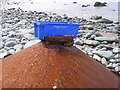
It's flotsam but is it art?
A large metal cone on the shore at Llwyngwril, topped by a bottomless box from South East Fish Distributors Wexford Ireland. Hard to believe the sea placed the box precisely on the circular collar. Was the bottom cut out specifically to fit? Hmmm...
Image: © E Gammie
Taken: 15 May 2009
0.10 miles
5
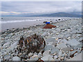
Flotsam, Llwyngwril shore
A roll of wire fencing and a ... err ... conical thing, pretty heavy duty metal and looks like it's been there a while. Barmouth rock (SH6115) in the distance. The time is 1331, high water at Barmouth was 1241.
Image: © E Gammie
Taken: 15 May 2009
0.10 miles
6
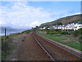
Cambrian Coast line at Llwyngwril
Looking towards the Mawddach estuary from the pedestrian crossing near the Quaker burial ground. From here the line heads along the cliff below Gallt Ffynnon-yr-hŷdd towards Fairbourne.
Image: © E Gammie
Taken: 9 May 2009
0.12 miles
7
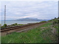
Cambrian Coast line, Llwyngwril
Looking across the line towards Barmouth in the distance (SH6115) from the path to the shore past the Quaker burial ground.
Image: © E Gammie
Taken: 10 May 2009
0.16 miles
8
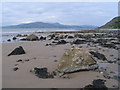
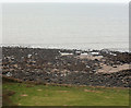
Rocky foreshore at Llwyngwril
The shore at Llwyngwril is fronted by low cliffs and is mainly boulders and large shingle, interspersed with a few sandy patches visible between high and low water. Taken at 1555, approximately 1 hour before low water (1647 in Barmouth). The hills behind Barmouth (SH6115) are visible in the distance.
Image: © E Gammie
Taken: 10 May 2009
0.17 miles
10
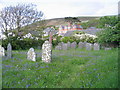
Friends burial ground, Llwyngwril
Mynwent Bryn Tallwyn burial ground. Bluebells and hawthorn in flower. In the 17th century many Quakers (members of the Religious Society of the Friends of Truth) settled here to avoid persecution elsewhere. Owen Humphrey of nearby Llwyn Du donated land for burials around 1664 (although the date wrought in the gate is 1646). When William Penn established settlements in the New World many migrated there. By 1876 there were no Quakers living locally and Wesleyans were granted the right to bury their dead here, with the western portion reserved for quaker burials.
Image: © E Gammie
Taken: 9 May 2009
0.18 miles