
IMAGES TAKEN NEAR TO
Y Berllan, PENMAENMAWR, LL34 6HF
Introduction
This page details the photographs taken nearby to Y Berllan, LL34 6HF by members of the Geograph project.
The Geograph project started in 2005 with the aim of publishing, organising and preserving representative images for every square kilometre of Great Britain, Ireland and the Isle of Man.

There are currently over 7.5m images from over14,400 individuals and you can help contribute to the project by visiting https://www.geograph.org.uk
Image Map
Images are licensed for reuse under creativecommons.org/licenses/by-sa/2.0
Notes
- Clicking on the map will re-center to the selected point.
- The higher the marker number, the further away the image location is from the centre of the postcode.
Image Listing (55 Images Found)
Images are licensed for reuse under creativecommons.org/licenses/by-sa/2.0
Image
Details
Distance
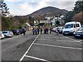
2
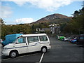
Part of the free car park in Penmaenmawr
A large free car park near the amenities and with inviting views of Foel Lus.
Image: © Jeremy Bolwell
Taken: 13 Oct 2011
0.05 miles
3
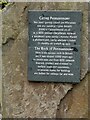
The Rock of Penmaenmawr
Set in the middle of the seating area below the library Image is a piece of Penmaenmawr Rock.
Carreg Penmaenmawr
Yma mae'r garreg caletaf ym Mhrydain
ond eto naddwyd i greu bwyelli
5000 o flynnyddoedd yn ol
ac o 1830 ymlaen chwythwyd, malwyd
a naddwyd i greu cerrig i wynebu ffyrdd
a phalmentydd, cerrig adeiladu a balast
i'r rheilffyrdd ymhell ag agos
The Rock of Penmaenmawr
Here is the hardest rock in Britain
yet it was shaped 5000 years ago
to create axes and from 1830 onwards
blasted, crushed and trimmed to
surface roads and pavements,
to provide stones for building
and ballast for railways far and wide
Image: © Gerald England
Taken: 26 Jun 2021
0.08 miles
4
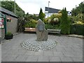
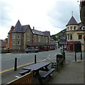
Seating area on Bangor Road
This area is below the library and between a bus stop and the Spar shop. In the centre is a piece of Penmaenmawr Rock Image
Image: © Gerald England
Taken: 26 Jun 2021
0.08 miles
7
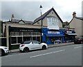
Shops on Old Conway Road
On the left is the Village Bistro. On the right is Dino's burger bar. In the middle is the Pen Phoenix Community Shop, a charity shop supporting Penmaenmawr Phoenix Football Club.
Image: © Gerald England
Taken: 26 Jun 2021
0.09 miles
9
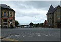
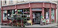
Brynmor Terrace
Off Bangor Road and leading down towards the station and the beach. On the left is Happy House Fish & Chips.
Image: © Gerald England
Taken: 26 Jun 2021
0.10 miles
10
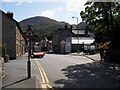
Bangor Road, Penmaenmawr
Viewed from the eastbound bus stop, Bangor Road is the main street of this small town which is now by-passed by the current A55. The building with a turret marks a cross roads and junction with Fernbrook Road.
Image: © Christopher Hall
Taken: 11 Aug 2014
0.10 miles