The Rock of Penmaenmawr
Introduction
The photograph on this page of The Rock of Penmaenmawr by Gerald England as part of the Geograph project.
The Geograph project started in 2005 with the aim of publishing, organising and preserving representative images for every square kilometre of Great Britain, Ireland and the Isle of Man.

There are currently over 7.5m images from over 14,400 individuals and you can help contribute to the project by visiting https://www.geograph.org.uk
The Rock of Penmaenmawr
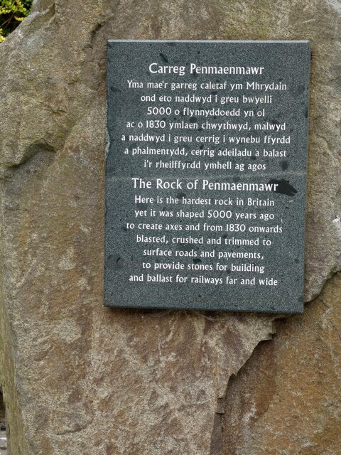
Image: © Gerald England Taken: 26 Jun 2021
Set in the middle of the seating area below the library Image is a piece of Penmaenmawr Rock. Carreg Penmaenmawr Yma mae'r garreg caletaf ym Mhrydain ond eto naddwyd i greu bwyelli 5000 o flynnyddoedd yn ol ac o 1830 ymlaen chwythwyd, malwyd a naddwyd i greu cerrig i wynebu ffyrdd a phalmentydd, cerrig adeiladu a balast i'r rheilffyrdd ymhell ag agos The Rock of Penmaenmawr Here is the hardest rock in Britain yet it was shaped 5000 years ago to create axes and from 1830 onwards blasted, crushed and trimmed to surface roads and pavements, to provide stones for building and ballast for railways far and wide
Images are licensed for reuse under creativecommons.org/licenses/by-sa/2.0
Image Location
Latitude
53.26799
Longitude
-3.922515