
IMAGES TAKEN NEAR TO
Bryn Difyr, PENMAENMAWR, LL34 6AH
Introduction
This page details the photographs taken nearby to Bryn Difyr, LL34 6AH by members of the Geograph project.
The Geograph project started in 2005 with the aim of publishing, organising and preserving representative images for every square kilometre of Great Britain, Ireland and the Isle of Man.

There are currently over 7.5m images from over14,400 individuals and you can help contribute to the project by visiting https://www.geograph.org.uk
Image Map
Images are licensed for reuse under creativecommons.org/licenses/by-sa/2.0
Notes
- Clicking on the map will re-center to the selected point.
- The higher the marker number, the further away the image location is from the centre of the postcode.
Image Listing (100 Images Found)
Images are licensed for reuse under creativecommons.org/licenses/by-sa/2.0
Image
Details
Distance
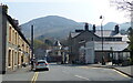
2
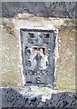
Ordnance Survey Flush Bracket (S0333)
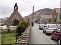
This OS Flush Bracket can be found on the wall of the chapel, Bangor Road. It marks a point 40.685m above mean sea level.
Image: © Adrian Dust
Taken: 26 Oct 2018
0.05 miles
3
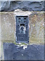
Flush bracket S0333 on Bangor Road, Penmaenmawr
This flush bracket is located on S side of Bangor Road in Penmaenmawr and it is shown in the Ordnance Survey database as being 40.6854m above the Newlyn datum.
Image: © Meirion
Taken: 17 Jan 2012
0.05 miles
4
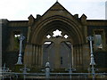
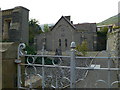
Berth Church, Penmaenmawr
The church is behind this Gothic gateway.
Image: © Eirian Evans
Taken: 24 Apr 2009
0.05 miles
7
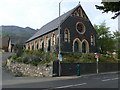
Penmaenmawr chapel
Disused chapel on Bangor Road, now up for sale.
Image: © Eirian Evans
Taken: 24 Apr 2009
0.06 miles
8
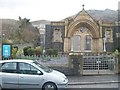
The preserved entrance to the former Berth Chapel
The main building has been demolished but interdenominational Welsh services are held in the former vestry to the rear. The chapel is now known as Eglwys y Berth ("bush church"). The Graig Lwyd granite quarry can be seen on the mountain above.
Image: © Eric Jones
Taken: 26 Mar 2010
0.06 miles
10
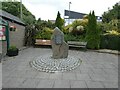
Seating area on Bangor Road
This area is below the library and between a bus stop and the Spar shop. In the centre is a piece of Penmaenmawr Rock Image
Image: © Gerald England
Taken: 26 Jun 2021
0.08 miles