
IMAGES TAKEN NEAR TO
Oakwood Park Mews, CONWY, LL32 8HL
Introduction
This page details the photographs taken nearby to Oakwood Park Mews, LL32 8HL by members of the Geograph project.
The Geograph project started in 2005 with the aim of publishing, organising and preserving representative images for every square kilometre of Great Britain, Ireland and the Isle of Man.

There are currently over 7.5m images from over14,400 individuals and you can help contribute to the project by visiting https://www.geograph.org.uk
Image Map
Images are licensed for reuse under creativecommons.org/licenses/by-sa/2.0
Notes
- Clicking on the map will re-center to the selected point.
- The higher the marker number, the further away the image location is from the centre of the postcode.
Image Listing (13 Images Found)
Images are licensed for reuse under creativecommons.org/licenses/by-sa/2.0
Image
Details
Distance
1
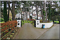
Oakwood Park Hall
A former hotel now split into separate residences, and now with three distinct driveways.
Image: © Bill Boaden
Taken: 18 Feb 2017
0.03 miles
2
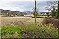
Footpath to Conwy
The path roughly follows the edge of the field, but the ground is currently quite soft.
Image: © Bill Boaden
Taken: 18 Feb 2017
0.05 miles
3
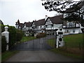
Oakwood Park Hall near Conwy
I am not sure, but it looks as if an old hotel has been converted into separate apartments here. The 1920's or '30's hotel building seems to have been split into two halves, then each half is further subdivided. Very interesting building. Nice place to live too I would assume.
Image: © Jeremy Bolwell
Taken: 8 Jan 2012
0.06 miles
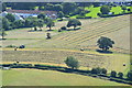
5
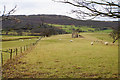
Sheep grazing on a former golf course
This was part of the Oakwood Park Hotel Golf Club, and presumably the ruined hut related to the course. Conwy Mountain rises impressively behind.
Image: © Bill Boaden
Taken: 18 Feb 2017
0.10 miles
6

Splendid Shed
What a fine folly. Perhaps it's too isolated to be kept in good repair.
Image: © Mike White
Taken: 5 Oct 2008
0.11 miles
7
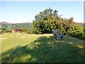
Bryn-mawr Summit
Track from NW then through edge of farmyard to grassy top with bench and new large barbecue spot with a lovely view and the weather to match.
Name: Bryn-mawr
Hill number: 14790
Height:143m / 469ft
Parent (Ma/M):2031 Tal y Fan
Section:30B: Snowdonia
Area:The Carneddau
County/UA:Conwy (CoU)
Class: Tump (100-199m)
Grid ref:SH 76567 76676
Summit feature: outcrop
Drop: 30m
Col:113m SH762763
Image: © Rude Health
Taken: 8 Sep 2015
0.17 miles
8
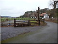
Footpath along a roadway near Conwy
Someone rides their pony over these poles on the corner. A couple of nice cottages stand beside the roadway.
Image: © Jeremy Bolwell
Taken: 8 Jan 2012
0.17 miles
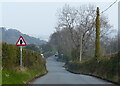
10
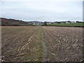
Footpath across winter fields near Conwy
The Mount Pleasant suburb of Conwy lies ahead.
Image: © Jeremy Bolwell
Taken: 8 Jan 2012
0.21 miles