IMAGES TAKEN NEAR TO
Coed Y Bwlch, CONWY, LL31 9YF
Introduction
This page details the photographs taken nearby to Coed Y Bwlch, LL31 9YF by members of the Geograph project.
The Geograph project started in 2005 with the aim of publishing, organising and preserving representative images for every square kilometre of Great Britain, Ireland and the Isle of Man.

There are currently over 7.5m images from over14,400 individuals and you can help contribute to the project by visiting https://www.geograph.org.uk
Image Map
Images are licensed for reuse under creativecommons.org/licenses/by-sa/2.0
Notes
- Clicking on the map will re-center to the selected point.
- The higher the marker number, the further away the image location is from the centre of the postcode.
Image Listing (34 Images Found)
Images are licensed for reuse under creativecommons.org/licenses/by-sa/2.0
Image
Details
Distance
1
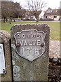
Old water valve marker on Pentywyn Road, Llandudno Junction
C.C.WATER
Image: © Meirion
Taken: 11 Mar 2020
0.03 miles
2
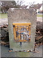
Hydrant marker on Pentywyn Road, Llandudno Junction
Image: © Meirion
Taken: 11 Mar 2020
0.04 miles
3
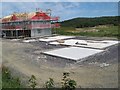
Bron Heulog 3
A new development of houses in progress on the farmland more commonly known as High Pastures. Here, only the floor slabs of additional buildings have been completed. A contrasting, earlier view of this scene is given here Image
Image: © Jonathan Wilkins
Taken: 19 Jul 2020
0.04 miles
4
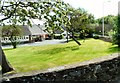
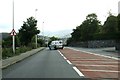
Junction of Marl Lane and Pentywyn Road
The bungalows are off Albert Drive. The shape of the trees indicates the direction of the prevailing winds.
Image: © Gerald England
Taken: 10 Jul 2014
0.05 miles
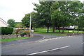
6

The new High Pastures
A development of new housing on part of the grounds of the High Pastures nursing home. Exclusive, luxury living is on offer - shame about the drains.
Image: © Jonathan Wilkins
Taken: 22 Oct 2008
0.05 miles
9
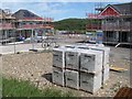
Bron Heulog 2
A new development of houses in progress on the farmland more commonly known as High Pastures. The stack of 'Aircrete' concrete blocks are unusual because they have originated in Ireland.
Image: © Jonathan Wilkins
Taken: 19 Jul 2020
0.07 miles
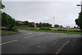
10
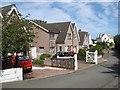
Bwlch Farm Road
A short road leading only to the farms of Bwlch and Bryn Tirion, which has been populated with more modern houses. In the distance the white houses were originally lodges associated with the Ty'n y Coed convalescent home. They replaced a Methodist chapel which stood on the spot until the end of the 19th century.
Image: © Jonathan Wilkins
Taken: 19 Jul 2020
0.08 miles