
IMAGES TAKEN NEAR TO
Cwrt Ysgol Maelgwn, LLANDUDNO JUNCTION, LL31 9FN
Introduction
This page details the photographs taken nearby to Cwrt Ysgol Maelgwn, LL31 9FN by members of the Geograph project.
The Geograph project started in 2005 with the aim of publishing, organising and preserving representative images for every square kilometre of Great Britain, Ireland and the Isle of Man.

There are currently over 7.5m images from over14,400 individuals and you can help contribute to the project by visiting https://www.geograph.org.uk
Image Map
Images are licensed for reuse under creativecommons.org/licenses/by-sa/2.0
Notes
- Clicking on the map will re-center to the selected point.
- The higher the marker number, the further away the image location is from the centre of the postcode.
Image Listing (348 Images Found)
Images are licensed for reuse under creativecommons.org/licenses/by-sa/2.0
Image
Details
Distance
1
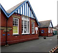
COUNCIL SCHOOL 1907 plaque, Llandudno Junction
The stone plaque on the left is on the wall of Ysgol Maelgwn http://www.geograph.org.uk/photo/4850243 which in 2016 provides primary education in Welsh-medium and English-medium streams. Originally named Llandudno Junction County School, the school was opened by Lord Stanley of Alderley in October 1907.
Image: © Jaggery
Taken: 27 Feb 2016
0.01 miles
2
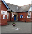
Reminder of Ysgol Maelgwn's Edwardian origin, Llandudno Junction
BOYS is inscribed in stone above a door. In 2016, Ysgol Maelgwn http://www.geograph.org.uk/photo/4850243 provides primary education in Welsh-medium and English-medium streams. Originally named Llandudno Junction County School, the school was opened by Lord Stanley of Alderley in October 1907.
Image: © Jaggery
Taken: 27 Feb 2016
0.01 miles
3
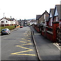
Zigzag yellow markings on Broad Street, Llandudno Junction
Marking a Keep Clear Zone outside a primary school, Ysgol Maelgwn. http://www.geograph.org.uk/photo/4850243
Image: © Jaggery
Taken: 27 Feb 2016
0.01 miles
4
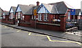
Ysgol Maelgwn, Llandudno Junction
Viewed across Broad Street. The school, originally named Llandudno Junction County School, was opened by Lord Stanley of Alderley in October 1907. In 2016, the school, now named Ysgol Maelgwn, provides primary education in Welsh-medium and English-medium streams.
Image: © Jaggery
Taken: 27 Feb 2016
0.02 miles
5
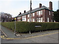
Plas Tre Marl name sign in a hedge, Llandudno Junction
On the corner of Broad Street and a dead-end street, Plas Tre Marl.
The name on the white board behind the hedge is
NORTH WALES HOUSING/TAI GOGLEDD CYMRU.
Image: © Jaggery
Taken: 27 Feb 2016
0.02 miles
6
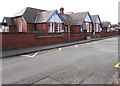
Ysgol Maelgwn, Llandudno Junction
Viewed across Broad Street. The school, originally named Llandudno Junction County School, was opened by Lord Stanley of Alderley in October 1907. In 2016, the school, now named Ysgol Maelgwn, provides primary education in Welsh-medium and English-medium streams.
Image: © Jaggery
Taken: 27 Feb 2016
0.02 miles
7
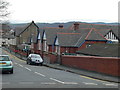
Ysgol Maelgwn, Llandudno Junction
Ysgol Maelgwn is a County Primary School for children between 3 - 11 years old.
It is situated on Broad Street, Llandudno Junction and was founded in 1907.
Image: © Eirian Evans
Taken: 28 Jan 2012
0.03 miles
8
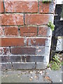
Benchmark on Broad Street, Llandudno Junction
This benchmark is located on the SW side of Broad Street in Llandudno Junction & it is shown in the current Ordnance Survey database at a height of 11.2166m above the Newlyn datum.
Image: © Meirion
Taken: 19 Jul 2011
0.03 miles
9
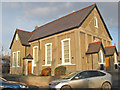
Capel Coffa 1
Addoldy yr annibynwyr trefn y moddion.
Welsh Independent chapel in Broad Street. A fine and extremely well-kept chapel in a most surprising location. Capel Coffa is an abbreviation for the Welsh coffadwriaethol or memorial, and an inscribed stone shows the dedication to the Venerable Arthur Jones born Llanrwst, Independent Minister, 1776-1860. The stone was dedicated in 1902 and that could also be the date of the chapel.
Image: © Jonathan Wilkins
Taken: 13 Jan 2012
0.03 miles
10
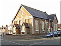
Capel Coffa 2
The northern side of the chapel adjacent to the westward continuation of Broad Street. For details see Image
Image: © Jonathan Wilkins
Taken: 13 Jan 2012
0.03 miles