
IMAGES TAKEN NEAR TO
Pendre Road, LLANDUDNO, LL30 3BH
Introduction
This page details the photographs taken nearby to Pendre Road, LL30 3BH by members of the Geograph project.
The Geograph project started in 2005 with the aim of publishing, organising and preserving representative images for every square kilometre of Great Britain, Ireland and the Isle of Man.

There are currently over 7.5m images from over14,400 individuals and you can help contribute to the project by visiting https://www.geograph.org.uk
Image Map
Images are licensed for reuse under creativecommons.org/licenses/by-sa/2.0
Notes
- Clicking on the map will re-center to the selected point.
- The higher the marker number, the further away the image location is from the centre of the postcode.
Image Listing (64 Images Found)
Images are licensed for reuse under creativecommons.org/licenses/by-sa/2.0
Image
Details
Distance
1
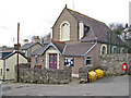
Village hall
The present village hall occupies a building that was originally a chapel. Elements of the architecture, especially the windows, are instantly recognisable. Originally the Ebenezer chapel, dated to 1892 by the stone plaque, the conversion for use as a village hall goes back to 1977.
Image: © Jonathan Wilkins
Taken: 21 Jan 2011
0.04 miles
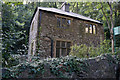
3
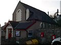
Penrhyn Side Village Hall
Formerly a chapel, the building was converted for use by the community.
Image: © Eirian Evans
Taken: 28 Jan 2012
0.05 miles
4

Penrhyn-side War Memorial
This roadside obelisk commemorates the men of the parish who fell in the Great War - of whom there is quite a long list - and the one individual killed in the Second World War. The memorial was unveiled in 1921. The roll of honour is given here: http://www.roll-of-honour.com/Caernarvonshire/Penrhynside.html
Image: © Stephen McKay
Taken: 4 Aug 2017
0.05 miles
5

War Memorial, Penrhyn Side
Half way down Pendre Hill, with the hillside of Little Orme behind it.
Image: © Eirian Evans
Taken: 28 Jan 2012
0.05 miles
6
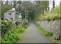
North Lodge along National Cycle Network Route 5
Image: © Mat Fascione
Taken: 16 Apr 2019
0.06 miles
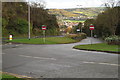
8
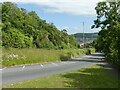
Penrhyn Hill
Now a dual carriageway, the far carriageway has taken over the trackbed of the former Llandudno and Colwyn Bay Electric Railway (tramway). This ran on a separate alignment to the old road to minimise the gradient.
Image: © Alan Murray-Rust
Taken: 22 Jun 2024
0.06 miles
10
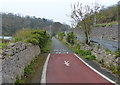
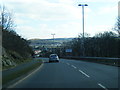
National Cycle Network Route 5
Heading up the B5115 Penrhyn Hill.
Image: © Mat Fascione
Taken: 16 Apr 2019
0.06 miles