
IMAGES TAKEN NEAR TO
Herkomer Road, LLANDUDNO, LL30 2YZ
Introduction
This page details the photographs taken nearby to Herkomer Road, LL30 2YZ by members of the Geograph project.
The Geograph project started in 2005 with the aim of publishing, organising and preserving representative images for every square kilometre of Great Britain, Ireland and the Isle of Man.

There are currently over 7.5m images from over14,400 individuals and you can help contribute to the project by visiting https://www.geograph.org.uk
Image Map
Images are licensed for reuse under creativecommons.org/licenses/by-sa/2.0
Notes
- Clicking on the map will re-center to the selected point.
- The higher the marker number, the further away the image location is from the centre of the postcode.
Image Listing (147 Images Found)
Images are licensed for reuse under creativecommons.org/licenses/by-sa/2.0
Image
Details
Distance
1
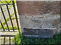
Ordnance Survey Cut Mark
This OS cut mark can be found on the gatepost of the Church Of Our Saviour. It marks a point 6.396m above mean sea level.
Image: © Adrian Dust
Taken: 27 Mar 2023
0.05 miles
2

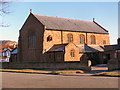
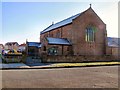
Llandudno Panorama
The West Shore is visible on the right.
Image: © Graham Taylor
Taken: 10 Nov 2008
0.05 miles
6
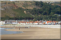
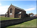
Llandudno West Beach
Looking North towards the Great Orme
Image: © Chris Shaw
Taken: Unknown
0.10 miles
7
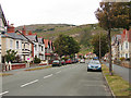
Lloyd Street West, Llandudno
This broad street is typical of the west side of the town.
Image: © John Lucas
Taken: 27 Jun 2008
0.11 miles
8
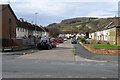
Denness Place, Llandudno
The houses here, leading off Trinity Avenue, are characteristic of local authority developments in the years immediately after the Second World War. They were in fact built in 1947 by Llandudno Urban District Council (UDC) in order to relieve what had become an acute housing shortage in the town. During the war a number of government departments had relocated from London to the area, which was seen as a safe haven from enemy bombing, thus boosting the local population. As servicemen returned from the forces after hostilities were ended there was an urgent need for new houses and Denness Place was one of a number of similar projects. Today many of the houses are privately owned.
Image: © Stephen McKay
Taken: 4 Oct 2024
0.12 miles
9
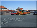
12 noon express to North Shore
A few minutes late leaving West Shore for its round trip.
Image: © Richard Hoare
Taken: 20 Jun 2011
0.12 miles
10
Ordnance Survey Rivet
This OS rivet can be found on the wall of No67 Brynian Road. It marks a point 6.276m above mean sea level.
Image: © Adrian Dust
Taken: 27 Mar 2023
0.12 miles