Denness Place, Llandudno
Introduction
The photograph on this page of Denness Place, Llandudno by Stephen McKay as part of the Geograph project.
The Geograph project started in 2005 with the aim of publishing, organising and preserving representative images for every square kilometre of Great Britain, Ireland and the Isle of Man.

There are currently over 7.5m images from over 14,400 individuals and you can help contribute to the project by visiting https://www.geograph.org.uk
Denness Place, Llandudno
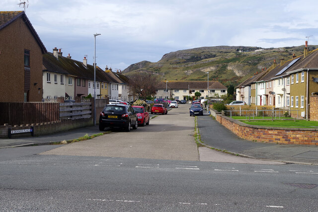
Image: © Stephen McKay Taken: 4 Oct 2024
The houses here, leading off Trinity Avenue, are characteristic of local authority developments in the years immediately after the Second World War. They were in fact built in 1947 by Llandudno Urban District Council (UDC) in order to relieve what had become an acute housing shortage in the town. During the war a number of government departments had relocated from London to the area, which was seen as a safe haven from enemy bombing, thus boosting the local population. As servicemen returned from the forces after hostilities were ended there was an urgent need for new houses and Denness Place was one of a number of similar projects. Today many of the houses are privately owned.
Images are licensed for reuse under creativecommons.org/licenses/by-sa/2.0
Image Location
Latitude
53.317531
Longitude
-3.836615