
IMAGES TAKEN NEAR TO
Russell Avenue, COLWYN BAY, LL29 7TR
Introduction
This page details the photographs taken nearby to Russell Avenue, LL29 7TR by members of the Geograph project.
The Geograph project started in 2005 with the aim of publishing, organising and preserving representative images for every square kilometre of Great Britain, Ireland and the Isle of Man.

There are currently over 7.5m images from over14,400 individuals and you can help contribute to the project by visiting https://www.geograph.org.uk
Image Map
Images are licensed for reuse under creativecommons.org/licenses/by-sa/2.0
Notes
- Clicking on the map will re-center to the selected point.
- The higher the marker number, the further away the image location is from the centre of the postcode.
Image Listing (68 Images Found)
Images are licensed for reuse under creativecommons.org/licenses/by-sa/2.0
Image
Details
Distance
3
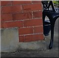
Ordnance Survey Cut Mark
This OS cut mark can be found on No28 Seafield Road. It marks a point 72.057m above mean sea level.
Image: © Adrian Dust
Taken: 14 Sep 2019
0.06 miles
4
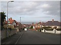
The steep end of Rhiw Road
Well-named, as Rhiw is the Welsh word for hillside. The houses are larger and set back from the road as one ascends from town, and the distant marine horizon opens up. A number 21 bus serves this stop on its circuit of the higher parts of Colwyn Bay.
Image: © Jonathan Wilkins
Taken: 6 Feb 2019
0.06 miles
5
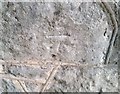
Ordnance Survey Cut Mark
This OS cut mark can be found on the wall of No28 Woodland Park. It marks a point 76.001m above mean sea level.
Image: © Adrian Dust
Taken: 14 Sep 2019
0.07 miles
6
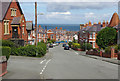
Rhiw Road, Colwyn Bay
Looking down into the town with Woodhill Baptist Church on the left. The church dates from 1902, originally as a Calvanistic Methodist chapel; it was taken over by the Baptists in 1935 although it only acquired its present name in the 1980s.
Image: © Stephen McKay
Taken: 7 Aug 2017
0.08 miles
7
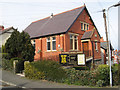
Woodhill Baptist Church
Situated on the corner of Rhiw Road and Wood Hill Road this is a very plain, brick building, though very elevated as a consequence of being built on the steepest part of the ascent to the woods. It is assumed that this is an English church as the Welsh Baptist church is elsewhere.
Image: © Jonathan Wilkins
Taken: 17 Mar 2009
0.08 miles
8
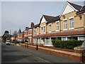
Hillside Road
Another splendid terrace, this one displaying very artistic brickwork in red and yellow with a decorative tiling motif on the continuous porch. Many of the corner buildings at the junctions sport elegant turrets as can be seen in the distance here.
Image: © Jonathan Wilkins
Taken: 17 Mar 2009
0.11 miles
9
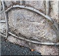
Ordnance Survey Cut Mark
This OS cut mark can be found on the wall between Nos 16 & 18 Rhiw Road. It marks a point 43.511m above mean sea level.
Image: © Adrian Dust
Taken: 14 Sep 2019
0.12 miles
10
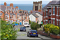
Rhiw Road, Colwyn Bay
Looking down into the town from Rhiw Road (hill or slope in English) with the tower of St Paul's church overlooking the scene.
Image: © Stephen McKay
Taken: 7 Aug 2017
0.12 miles