
IMAGES TAKEN NEAR TO
Grange Road, COLWYN BAY, LL29 7RN
Introduction
This page details the photographs taken nearby to Grange Road, LL29 7RN by members of the Geograph project.
The Geograph project started in 2005 with the aim of publishing, organising and preserving representative images for every square kilometre of Great Britain, Ireland and the Isle of Man.

There are currently over 7.5m images from over14,400 individuals and you can help contribute to the project by visiting https://www.geograph.org.uk
Image Map
Images are licensed for reuse under creativecommons.org/licenses/by-sa/2.0
Notes
- Clicking on the map will re-center to the selected point.
- The higher the marker number, the further away the image location is from the centre of the postcode.
Image Listing (116 Images Found)
Images are licensed for reuse under creativecommons.org/licenses/by-sa/2.0
Image
Details
Distance
1
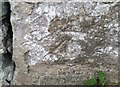
Ordnance Survey Cut Mark
This OS cut mark can be found on the wall south side of Old Highway. It marks a point 62.929m above mean sea level.
Image: © Adrian Dust
Taken: 14 Sep 2019
0.07 miles
2
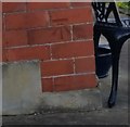
Ordnance Survey Cut Mark
This OS cut mark can be found on No28 Seafield Road. It marks a point 72.057m above mean sea level.
Image: © Adrian Dust
Taken: 14 Sep 2019
0.09 miles
5
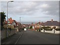
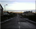
The steep end of Rhiw Road
Well-named, as Rhiw is the Welsh word for hillside. The houses are larger and set back from the road as one ascends from town, and the distant marine horizon opens up. A number 21 bus serves this stop on its circuit of the higher parts of Colwyn Bay.
Image: © Jonathan Wilkins
Taken: 6 Feb 2019
0.12 miles
6
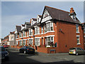
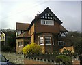
Grove Park
The streets leading off Rhiw Road contain a number of excellent terraces and town houses. Most have been refurbished in an extensive programme of urban renewal and this is typical of the results. The growth of Colwyn Bay was quite rapid and carefully planned in the late Victorian period and there is great variety in the development as well as pride in the appearance of the new seaside town.
Image: © Jonathan Wilkins
Taken: 16 Mar 2009
0.13 miles
7
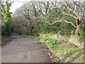
Pen-y-bryn Road 1
Pen-y-bryn Road was previously the only alternative to the exceedingly steep descent of the Llanrwst Road, being by-passed by 1914 by the equally steep King's Drive. Most of the road is not paved, as seen here descending through the woods.
Image: © Jonathan Wilkins
Taken: 6 Feb 2019
0.13 miles
8
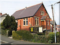
Woodhill Baptist Church
Situated on the corner of Rhiw Road and Wood Hill Road this is a very plain, brick building, though very elevated as a consequence of being built on the steepest part of the ascent to the woods. It is assumed that this is an English church as the Welsh Baptist church is elsewhere.
Image: © Jonathan Wilkins
Taken: 17 Mar 2009
0.13 miles
9
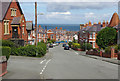
Rhiw Road, Colwyn Bay
Looking down into the town with Woodhill Baptist Church on the left. The church dates from 1902, originally as a Calvanistic Methodist chapel; it was taken over by the Baptists in 1935 although it only acquired its present name in the 1980s.
Image: © Stephen McKay
Taken: 7 Aug 2017
0.13 miles
10
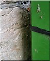
Ordnance Survey Cut Mark
This OS cut mark can be found on the wall at the entrance to Nant Y Gwyn Hall, Old Highway. It marks a point 46.209m above mean sea level.
Image: © Adrian Dust
Taken: 14 Sep 2019
0.14 miles