IMAGES TAKEN NEAR TO
Nant Ddu, ABERGELE, LL22 9BG
Introduction
This page details the photographs taken nearby to Nant Ddu, LL22 9BG by members of the Geograph project.
The Geograph project started in 2005 with the aim of publishing, organising and preserving representative images for every square kilometre of Great Britain, Ireland and the Isle of Man.

There are currently over 7.5m images from over14,400 individuals and you can help contribute to the project by visiting https://www.geograph.org.uk
Image Map
Images are licensed for reuse under creativecommons.org/licenses/by-sa/2.0
Notes
- Clicking on the map will re-center to the selected point.
- The higher the marker number, the further away the image location is from the centre of the postcode.
Image Listing (8 Images Found)
Images are licensed for reuse under creativecommons.org/licenses/by-sa/2.0
Image
Details
Distance
1
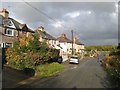
Nant Ddu Road
Houses in Nant Ddu Road, approaching the junction with St.Asaph Road. This section of road has been cut by the A55 Bodelwyddan by-pass and has been replaced by a new road and bridge slightly to the East.
Image: © Jonathan Wilkins
Taken: 9 Nov 2016
0.02 miles
2
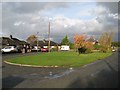
Nant Ddu Road 2
An unexpected green space near to the terminus of the truncated road (see also Image).
Image: © Jonathan Wilkins
Taken: 9 Nov 2016
0.05 miles
3
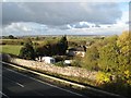
Nant Ddu Road meets the A55
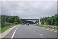
A view from the new bridge which raises Nant Ddu Road over the A55 dual-carriageway. The substantial new wall blocks the end of the old road and offers some shelter to the residents.
Image: © Jonathan Wilkins
Taken: 9 Nov 2016
0.07 miles
5
Sheep pasture
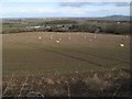
Long shadows from nearby pylons are thrown across the depleted pasture. The distant view takes in Bodtegwel and the new, lower end of Nant Ddu Road, although the A55 dual carriageway is neatly hidden in a cutting here. The surprise is the extensive solar energy facility, which looks like a lake (see Image).
Image: © Jonathan Wilkins
Taken: 12 Feb 2018
0.20 miles
6
Golden Field
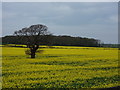
Rape seed fields, Plas Kinmel, near St George Llansan Sior.
Image: © J Scott
Taken: 15 Apr 2011
0.22 miles
7
Pasture with pylons
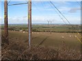
Sparse pasture at the end of winter. Pylons can be a problem, so here they have become a subject. The edge of the Morfa Gele is quite abrupt, and occupied by the A55 Abergele By-pass which is almost hidden by a hedge in this view.
Image: © Jonathan Wilkins
Taken: 12 Feb 2018
0.23 miles