IMAGES TAKEN NEAR TO
Llangernyw, ABERGELE, LL22 8PU
Introduction
This page details the photographs taken nearby to LL22 8PU by members of the Geograph project.
The Geograph project started in 2005 with the aim of publishing, organising and preserving representative images for every square kilometre of Great Britain, Ireland and the Isle of Man.

There are currently over 7.5m images from over14,400 individuals and you can help contribute to the project by visiting https://www.geograph.org.uk
Image Map
Images are licensed for reuse under creativecommons.org/licenses/by-sa/2.0
Notes
- Clicking on the map will re-center to the selected point.
- The higher the marker number, the further away the image location is from the centre of the postcode.
Image Listing (6 Images Found)
Images are licensed for reuse under creativecommons.org/licenses/by-sa/2.0
Image
Details
Distance
1
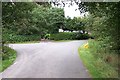
Road Junction at Wenlli near Llangernyw
This junction of two minor roads at Wenlli Southeast of Llangernyw is at grid reference SH 84305 65717.
Image: © Terry Hughes
Taken: 13 Aug 2006
0.03 miles
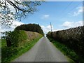
2
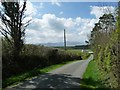
The road west to Wenlli
Dropping down from about 300 metres above sea level.
Image: © Christine Johnstone
Taken: 2 May 2017
0.06 miles
3
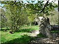
Fallen tree at the south end of Coed Pant y Rhedyn
Just east of the Lodge.
Image: © Christine Johnstone
Taken: 2 May 2017
0.07 miles
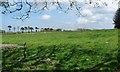
4
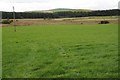
Upland grazing near Wenlli
View across upland grazing with the wooded Wenlli in the middle distance.
Image: © Philip Halling
Taken: 16 Aug 2014
0.11 miles
5
The road to Bodunig and Penffordd Deg
Looking east, towards the western tip of Long Covert.
Image: © Christine Johnstone
Taken: 2 May 2017
0.12 miles
6
Pasture field,east of Wenlli
The 'pom-pom' trees line the track from Lodge to Hafodunos Hall.
Image: © Christine Johnstone
Taken: 2 May 2017
0.15 miles