
IMAGES TAKEN NEAR TO
Maes Y Dre, ABERGELE, LL22 7HP
Introduction
This page details the photographs taken nearby to Maes Y Dre, LL22 7HP by members of the Geograph project.
The Geograph project started in 2005 with the aim of publishing, organising and preserving representative images for every square kilometre of Great Britain, Ireland and the Isle of Man.

There are currently over 7.5m images from over14,400 individuals and you can help contribute to the project by visiting https://www.geograph.org.uk
Image Map
Images are licensed for reuse under creativecommons.org/licenses/by-sa/2.0
Notes
- Clicking on the map will re-center to the selected point.
- The higher the marker number, the further away the image location is from the centre of the postcode.
Image Listing (10 Images Found)
Images are licensed for reuse under creativecommons.org/licenses/by-sa/2.0
Image
Details
Distance
1
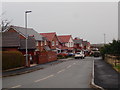
Estate of houses at Hendre Las, Abergele
Image: © Eirian Evans
Taken: 9 Mar 2020
0.09 miles
2
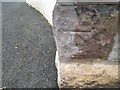
Ordnance Survey Cut Mark
This OS cut mark can be found on the wall of Glyn on St George Road. It marks a point 19.897m above mean sea level.
Image: © Adrian Dust
Taken: 28 Mar 2023
0.14 miles
4
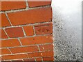
Ordnance Survey Cut Mark
This OS cut mark can be found on the old school, Bridge Street. It marks a point 16.540m above mean sea level.
Image: © Adrian Dust
Taken: 28 Mar 2023
0.15 miles
6
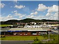
Faenol Avenue, Abergele
Threeways Garage, Faenol Avenue, Abergele, viewed from the A55.
Image: © Gerald England
Taken: 4 Jul 2008
0.19 miles
7
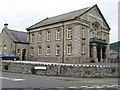
St.Paul's Chapel
The first Wesleyan Methodist chapel was built in 1804 and replaced in 1837. The town celebrated the start of work on this new chapel with general holiday in 1880. The design of this chapel is due to Richard Davies of Bangor, born in Llanfairfechan, and this is typical of his work.
Image: © Jonathan Wilkins
Taken: 7 Aug 2008
0.21 miles
8
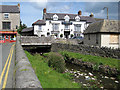
Pen -y-Bont Inn
This view shows both the inn and the bridge over the Afon Gele. This long-established family and commercial hotel has changed very little since the 1900's apart from the ubiquitous white paint.
Image: © Jonathan Wilkins
Taken: 14 Aug 2008
0.23 miles
9
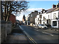
Abergele High Street, looking west
This is the A547 through Abergele. Of course nearly all the traffic now uses the A55.
The Pen-y-bont Inn, on the right, scored a few brownie points with me. I happened to knock my glass of wine over when I had already drunk about 75% of it. I ordered another one, but when I tried to pay for it, they refused. I could understand that for a regular customer, but for a complete stranger who will probably never be in Abergele again, I thought that pretty good. I have, of course, no connection with the inn, but thought such things should be noted.
Image: © David Purchase
Taken: 26 Dec 2017
0.23 miles
10
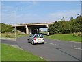
Threeways fly-over
The over-bridge on the north-western side of the Threeways roundabout, junction 24 on the A55. This point marked the eastern end of the Abergele By-pass dual-carriageway until the section from here to the foot of Rhuallt Hill was opened in the 1980's.
Image: © Jonathan Wilkins
Taken: 17 Sep 2008
0.25 miles