
IMAGES TAKEN NEAR TO
Cae Bach, CORWEN, LL21 0TJ
Introduction
This page details the photographs taken nearby to Cae Bach, LL21 0TJ by members of the Geograph project.
The Geograph project started in 2005 with the aim of publishing, organising and preserving representative images for every square kilometre of Great Britain, Ireland and the Isle of Man.

There are currently over 7.5m images from over14,400 individuals and you can help contribute to the project by visiting https://www.geograph.org.uk
Image Map
Images are licensed for reuse under creativecommons.org/licenses/by-sa/2.0
Notes
- Clicking on the map will re-center to the selected point.
- The higher the marker number, the further away the image location is from the centre of the postcode.
Image Listing (81 Images Found)
Images are licensed for reuse under creativecommons.org/licenses/by-sa/2.0
Image
Details
Distance
1
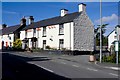
Dudley Arms Hotel
There's an entrance to the Ladies' from the car park. Not many pubs have such a convenient convenience.
Image: © Mike White
Taken: 7 Oct 2010
0.01 miles
2
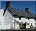
The former Bell Inn, Llandrillo
Grade II listed https://britishlistedbuildings.co.uk/300000681-the-bell-inn-llandrillo#.XP0I_FxKjcs in 1996, the one-time Bell Inn is now a private home, but dates from 1748, and is listed as "a good dated C18 building of vernacular character, which contributes to the Conservation Area"
Image: © Richard Law
Taken: 15 May 2019
0.02 miles
3
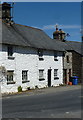
No 4 High Street, Llandrillo
Grade II listed https://britishlistedbuildings.co.uk/300000682-no4-high-streetclwyd-llandrillo#.XP0Kb1xKjcs, along with the adjacent cottage to its left which was once a public house Image in 1996. It was probably erected at much the same time as that building, which puts it around the late 1740s.
Image: © Richard Law
Taken: 15 May 2019
0.02 miles
4
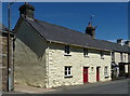
Nos 5 & 6 High Street, Llandrillo
Pictured together here are two semi-detached cottages which date from around the late 18th century, and which were Grade II listed https://britishlistedbuildings.co.uk/300000683-no5-high-streetclwyd-llandrillo#.XQt_D4hKhPY & https://britishlistedbuildings.co.uk/300000684-no6-high-streetclwyd-llandrillo#.XQt_K4hKhPY in 1966.
Image: © Richard Law
Taken: 15 May 2019
0.02 miles
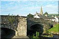
6
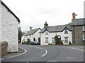
Tyre marks on the High Street bend
Llandrillo is no stranger to the descendants of Jehu, the son of Nimshi.
Image: © Eric Jones
Taken: 7 Jun 2007
0.03 miles
7
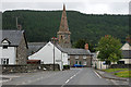
The B4401 in Llandrillo
About to execute a right-angled bend.
Image: © Nigel Brown
Taken: 27 May 2009
0.03 miles
8
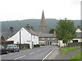
The centre of the village of Llandrillo
Llandrillo has a charming eighteenth century core.
Image: © Eric Jones
Taken: 7 Jun 2007
0.03 miles
9
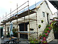
Former cart-shed and stables behind the Dudley Arms, Llandrillo
Thought to be contemporary with the hotel/pub immediately in front of it, and which in turn dates from the late 18th or early 19th century; the stables were shown on the tithe map of 1843. This vernacular building was Grade II listed https://britishlistedbuildings.co.uk/300081883-former-cart-shed-and-stable-at-dudley-arms-hotel-llandrillo#.YPmqzOhKjIU in 2003. The roof was being repaired at the time of this visit in June 2021.
Image: © Richard Law
Taken: 27 Jun 2021
0.03 miles
