Nos 5 & 6 High Street, Llandrillo
Introduction
The photograph on this page of Nos 5 & 6 High Street, Llandrillo by Richard Law as part of the Geograph project.
The Geograph project started in 2005 with the aim of publishing, organising and preserving representative images for every square kilometre of Great Britain, Ireland and the Isle of Man.

There are currently over 7.5m images from over 14,400 individuals and you can help contribute to the project by visiting https://www.geograph.org.uk
Nos 5 & 6 High Street, Llandrillo
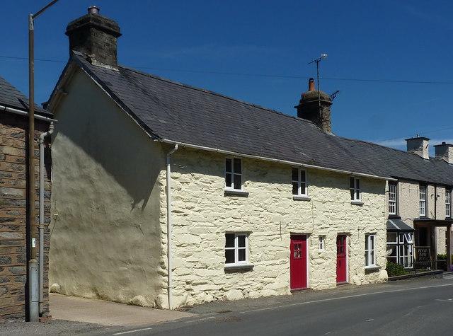
Image: © Richard Law Taken: 15 May 2019
Pictured together here are two semi-detached cottages which date from around the late 18th century, and which were Grade II listed https://britishlistedbuildings.co.uk/300000683-no5-high-streetclwyd-llandrillo#.XQt_D4hKhPY & https://britishlistedbuildings.co.uk/300000684-no6-high-streetclwyd-llandrillo#.XQt_K4hKhPY in 1966.
Images are licensed for reuse under creativecommons.org/licenses/by-sa/2.0
Image Location
Latitude
52.922777
Longitude
-3.438153