
IMAGES TAKEN NEAR TO
Y Felin Goed, CORWEN, LL21 0SJ
Introduction
This page details the photographs taken nearby to Y Felin Goed, LL21 0SJ by members of the Geograph project.
The Geograph project started in 2005 with the aim of publishing, organising and preserving representative images for every square kilometre of Great Britain, Ireland and the Isle of Man.

There are currently over 7.5m images from over14,400 individuals and you can help contribute to the project by visiting https://www.geograph.org.uk
Image Map
Images are licensed for reuse under creativecommons.org/licenses/by-sa/2.0
Notes
- Clicking on the map will re-center to the selected point.
- The higher the marker number, the further away the image location is from the centre of the postcode.
Image Listing (74 Images Found)
Images are licensed for reuse under creativecommons.org/licenses/by-sa/2.0
Image
Details
Distance
1
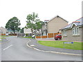
Y Felin Goed Estate
These new houses are built on the site of the former saw mill. 'Melin goed' means a 'timber mill'.
Image: © Eric Jones
Taken: 7 Jun 2007
0.04 miles
2
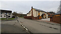
Recently built housing in Llandrillo
This is just one small section of an area occupied by a series of small modern housing developments which have enlarged Llandrillo to its south.
Image: © Andy Waddington
Taken: 11 Feb 2023
0.05 miles
3
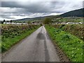
Looking towards Llandrillo from the road to Dinam
Image: © David Medcalf
Taken: 3 May 2019
0.05 miles
4
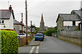
Road into Llandrillo
Passing the end of Rhos Llan with St Trillo's Church ahead.
Image: © Bill Boaden
Taken: 7 Sep 2017
0.06 miles
5
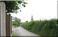
The narrow Cwm Pennant road at Llandrillo
This road is quite unsuitable to the needs of traffic accessing the new estates from the B4401. The tower of St Trillo's Church marks the position of the centre of the village.
Image: © Eric Jones
Taken: 7 Jun 2007
0.07 miles
8
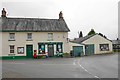
Village shop and post office
The centre of the village from which all local walking routes start.
Image: © Bill Boaden
Taken: 7 Sep 2017
0.15 miles
9
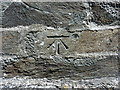
OS benchmark & bolt - Llandrillo, St Trillo's church
Levelled in 1942 at 161.945m above Ordnance Datum Newlyn, although the bolt predates that by a considerable period, being shown on older maps (circa 1900) at 531.1ft above sea level. That in turn would probably have referred to Liverpool Datum, in so much as the PA bolt is likely to have been installed during the 1st Primary Levelling of England & Wales in 1859.
Image: © Richard Law
Taken: 15 May 2019
0.15 miles
10
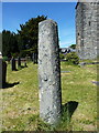
Cross shaft used as a sundial
Probably a medieval preaching cross shaft, cut down in the 18th century for use as a sundial (there is a small sundial on the upper surface) and Grade II listed https://britishlistedbuildings.co.uk/300081892-sun-dial-in-churchyard-llandrillo#.XP1yz1xKjcs in 2003.
Image: © Richard Law
Taken: 15 May 2019
0.15 miles