Cross shaft used as a sundial
Introduction
The photograph on this page of Cross shaft used as a sundial by Richard Law as part of the Geograph project.
The Geograph project started in 2005 with the aim of publishing, organising and preserving representative images for every square kilometre of Great Britain, Ireland and the Isle of Man.

There are currently over 7.5m images from over 14,400 individuals and you can help contribute to the project by visiting https://www.geograph.org.uk
Cross shaft used as a sundial
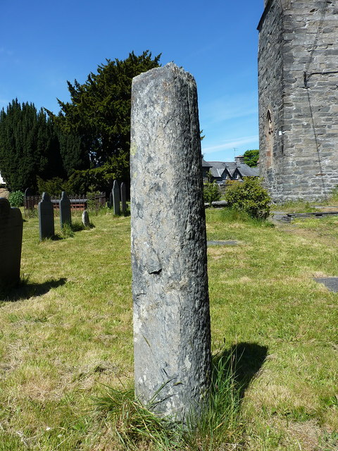
Image: © Richard Law Taken: 15 May 2019
Probably a medieval preaching cross shaft, cut down in the 18th century for use as a sundial (there is a small sundial on the upper surface) and Grade II listed https://britishlistedbuildings.co.uk/300081892-sun-dial-in-churchyard-llandrillo#.XP1yz1xKjcs in 2003.
Images are licensed for reuse under creativecommons.org/licenses/by-sa/2.0
Image Location


Leaflet Map data © OpenStreetMap
Latitude
52.922161
Longitude
-3.437776