
IMAGES TAKEN NEAR TO
Tan Y Fron Lane, LLANGOLLEN, LL20 8EL
Introduction
This page details the photographs taken nearby to Tan Y Fron Lane, LL20 8EL by members of the Geograph project.
The Geograph project started in 2005 with the aim of publishing, organising and preserving representative images for every square kilometre of Great Britain, Ireland and the Isle of Man.

There are currently over 7.5m images from over14,400 individuals and you can help contribute to the project by visiting https://www.geograph.org.uk
Image Map
Images are licensed for reuse under creativecommons.org/licenses/by-sa/2.0
Notes
- Clicking on the map will re-center to the selected point.
- The higher the marker number, the further away the image location is from the centre of the postcode.
Image Listing (15 Images Found)
Images are licensed for reuse under creativecommons.org/licenses/by-sa/2.0
Image
Details
Distance
1

Track to Fron Fawr
This track leads to several properties and is also the route of the Taith Clwyd (Clwydian way).
Image: © John Haynes
Taken: 19 Mar 2009
0.04 miles
2
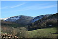
Looking Across the River
A snowy February scene above Llangollen.
Image: © Geoff Evans
Taken: 4 Feb 2015
0.09 miles
3

Track near Fron Fawr
Modern traffic is slowly pushing this track down the hill. In places it is supported by "armco" Image It is also Taith Clwyd (Clwydian Way).
Image: © John Haynes
Taken: 19 Mar 2009
0.12 miles
4
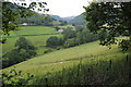
The Eglwyseg valley
View across the Eglwyseg River valley from the Clwydian Way to the north of Pentrefelin.
Image: © Philip Halling
Taken: 18 Aug 2011
0.13 miles
5
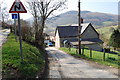
Tan-y-fron from the east
Another view of this farm which is on the Taith Clwyd which goes along the track to the left.
Image: © John Haynes
Taken: 19 Mar 2009
0.13 miles
6
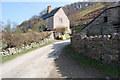
Tan-y-fron from the west
The Taith Clwyd (Clwydian Way) weaves around this farm before continuing towards Valle Crucis Abbey.
Image: © John Haynes
Taken: 19 Mar 2009
0.14 miles
7

View across to Hen-bandy from the Taith Clwyd
Great views at this time of the year.
Image: © John Haynes
Taken: 19 Mar 2009
0.15 miles
8
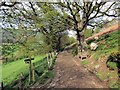
Trac ger Ffarm yr Hendre/ Track near Hendre Farm
Trac a chyffordd o lwybrau ger Ffarm yr Hendre (adfail).
A track and a junction of paths near the ruined Hendre Farm (trans. winter dwelling).
Image: © Alan Richards
Taken: 28 Apr 2014
0.17 miles
9

Path with a view
The path from the Taith Clwyd down towards Hen-bandy.
Image: © John Haynes
Taken: 19 Mar 2009
0.18 miles
10
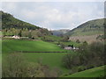
Valley view
Looking NW across the valley of the River Eglwyseg.
Image: © John H Darch
Taken: 28 Apr 2018
0.18 miles