
IMAGES TAKEN NEAR TO
Hillside, PRESTATYN, LL19 9EN
Introduction
This page details the photographs taken nearby to Hillside, LL19 9EN by members of the Geograph project.
The Geograph project started in 2005 with the aim of publishing, organising and preserving representative images for every square kilometre of Great Britain, Ireland and the Isle of Man.

There are currently over 7.5m images from over14,400 individuals and you can help contribute to the project by visiting https://www.geograph.org.uk
Image Map
Images are licensed for reuse under creativecommons.org/licenses/by-sa/2.0
Notes
- Clicking on the map will re-center to the selected point.
- The higher the marker number, the further away the image location is from the centre of the postcode.
Image Listing (20 Images Found)
Images are licensed for reuse under creativecommons.org/licenses/by-sa/2.0
Image
Details
Distance
1
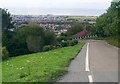
The steep road down Prestatyn hillside
This road is very steep and is not recommended for general traffic.
Image: © David and Rachel Landin
Taken: 31 Jul 2005
0.04 miles
2
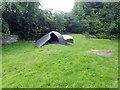
Roman Helmet, Hillside Gardens
A bold, uplifting and memorable sculpture inspired by Prestatyn's rich Roman heritage.
Image: © Eirian Evans
Taken: 22 Jul 2020
0.06 miles
3
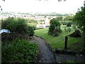
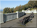
View over Prestatyn from public gardens on Prestatyn Hillside
As the Offa's Dyke Path traverses the steep hillside there is a public park with walkways, seating and a large shelter / viewing platform, offering views over the town and coastline and out to sea.
Image: © Jeremy Bolwell
Taken: 27 Aug 2010
0.08 miles
4
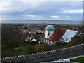
Prestatyn Ucha / Upper Prestatyn
Ty crand / Grand house
Image: © Ian Medcalf
Taken: 5 Apr 2010
0.08 miles
6
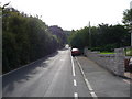
Part of Offa's Dyke Path through Prestatyn
Here, once out of the town, the waymarked long-distance footpath traverses suburban roads as it climbs towards Prestatyn Hillside ahead, passing substantial homes with large mature gardens.
Image: © Jeremy Bolwell
Taken: 27 Aug 2010
0.09 miles
7
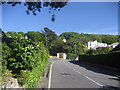
Fforddlas, Prestatyn
The Offa's Dyke National Trail adopts this road after descending down from the Prestatyn Hillside Nature Reserve, and following a straight course to the sea front.
Image: © Chris Heaton
Taken: 12 May 2009
0.09 miles
9
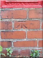
Bench mark in Fforddlas, Prestatyn
This Ordnance Survey bench mark is cut into a brick wall below an Edward VII post-box in Fforddlas, Prestatyn - Image It is alongside the Offa's Dyke Long Distance Path, and opposite Pendle Avenue - Image
Image: © John S Turner
Taken: 28 Aug 2012
0.10 miles
10
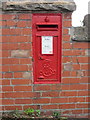
Edward VII post-box in Fforddlas, Prestatyn
This Edward VII post-box is set into a brick wall in Fforddlas, Prestatyn. It is alongside the Offa's Dyke Long Distance Path, and opposite Pendle Avenue. There is an Ordnance Survey bench mark cut into the wall below the post-box - Image
Image: © John S Turner
Taken: 28 Aug 2012
0.10 miles