1
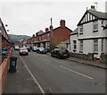
Warren Road, Prestatyn
Viewed from Marine Road. Warren Road leads to Caradoc Road.
Image: © Jaggery
Taken: 9 Feb 2017
0.04 miles
2
Chester to Holyhead railway line
Looking westwards along the railway line from the A549 bridge. Next stop, Prestatyn, then Rhyl.
Image: © Eirian Evans
Taken: 11 Jan 2008
0.05 miles
3
East side of Hafod Road, Prestatyn
Long row of houses viewed from the corner of Marine Road.
Image: © Jaggery
Taken: 9 Feb 2017
0.06 miles
4
Queen Elizabeth II postbox, Warren Road, Prestatyn
In a brick pillar near the corner of Marine Drive.
Image: © Jaggery
Taken: 9 Feb 2017
0.06 miles
5
Hafod Road, Prestatyn
From the corner of Marine Road along Hafod Road towards Warren Road and Caradoc Road.
Image: © Jaggery
Taken: 9 Feb 2017
0.06 miles
6
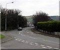
A548 Prestatyn Road, Prestatyn
Viewed from the Marine Road East junction, were the A548 Marine Road becomes
the A548 Prestatyn Road ahead. A nearby sign pointing this way shows Flint 14 (miles).
Image: © Jaggery
Taken: 9 Feb 2017
0.06 miles
7
A548 distances from Prestatyn
Opposite the Marine Road East junction, the sign is near the point where the A548 Marine Road
becomes the A548 Prestatyn Road, 3 miles from Rhyl, 14 miles from Flint (Fflint in Welsh).
Image: © Jaggery
Taken: 9 Feb 2017
0.07 miles
8
Warren Drive, Prestatyn
Warren Drive is on the corner of Barkby Avenue and the A548, on the north side of the railway
Image: © Eirian Evans
Taken: 11 Jan 2008
0.08 miles
9
Winter coats on!
Four horses in rather a muddy field near Warren Drive, Prestatyn
Image: © Eirian Evans
Taken: 11 Jan 2008
0.08 miles
10
Ordnance Survey Cut Mark
This OS cut mark can be found on the NE parapet of the railway bridge. It marks a point 11.040m above mean sea level.
Image: © Adrian Dust
Taken: 15 Sep 2019
0.08 miles


